Kafr Nan
| Kafr Nan كفرنان Kefer Nen[1] ( كفر نان ) | |
|---|---|
| Village | |
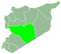
 Kafr Nan Location in Syria | |
| Coordinates: 34°53′11″N 36°38′53″E / 34.88639°N 36.64806°ECoordinates: 34°53′11″N 36°38′53″E / 34.88639°N 36.64806°E | |
| Country |
|
| Governorate | Homs |
| District | Al-Rastan |
| Subdistrict | Al-Rastan |
| Population (2004) | |
| • Total | 3,231 |
| Time zone | UTC+3 (EET) |
| • Summer (DST) | UTC+2 (EEST) |
Kfarnan
Kafar Nan (Turkish: Kefer Nen,[1] Arabic: كفر نان, translit. Kafar Nan) or Kafr Nan (Arabic: كفرنان, translit. Kafrnan, also spelled Kfarnan) is a village in northern Syria, administratively part of the Homs Governorate, located north of Homs. Nearby localities include Burj Qa'i to the west, Kisin to the northwest, Gharnatah to the northeast, al-Zaafaraniyah to the east, Talbiseh to the southeast, Tasnin to the south and Akrad Dayasinah to the southeast. According to the Syria Central Bureau of Statistics (CBS), Kafr Nan had a population of 3,231 in the 2004 census.[2] Its inhabitants are predominantly Alawites.[3]
History
References
- 1 2 Günümüzde Suriye Türkmenleri. — Suriye’de Değişimin Ortaya Çıkardığı Toplum: Suriye Türkmenleri, p. 14 ORSAM Rapor № 83. ORSAM – Ortadoğu Türkmenleri Programı Rapor № 14. Ankara — November 2011, 33 pages.
- ↑ General Census of Population and Housing 2004. Syria Central Bureau of Statistics (CBS). Homs Governorate. (in Arabic)
- ↑ "Syria: Humanitarian aid cannot enter Qusair until fighting over". The Daily Star (Lebanon). 2013-06-13.
- ↑ Smith, 1841, p. 179.
Bibliography
- Smith, Eli; Robinson, Edward (1841). Biblical Researches in Palestine, Mount Sinai and Arabia Petraea: A Journal of Travels in the Year 1838. 3. Crocker and Brewster.
|  | |||||||||||||||||||||||||||||
|
| ||||||||||||||||||||||||||||||
| ||||||||||||||||||||||||||||||
| ||||||||||||||||||||||||||||||
| ||||||||||||||||||||||||||||||
This article is issued from
Wikipedia.
The text is licensed under Creative Commons - Attribution - Sharealike.
Additional terms may apply for the media files.