Tarampa
| Tarampa Somerset Region, Queensland | |||||||||||||||
|---|---|---|---|---|---|---|---|---|---|---|---|---|---|---|---|
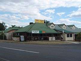 Tarampa Hotel, 2014 | |||||||||||||||
 Tarampa | |||||||||||||||
| Coordinates | 27°27′42.5″S 152°29′23.94″E / 27.461806°S 152.4899833°ECoordinates: 27°27′42.5″S 152°29′23.94″E / 27.461806°S 152.4899833°E | ||||||||||||||
| Population | 325 (2011 census)[1] | ||||||||||||||
| Postcode(s) | 4311 | ||||||||||||||
| LGA(s) | Somerset Region | ||||||||||||||
| State electorate(s) | Lockyer | ||||||||||||||
| Federal Division(s) | Blair | ||||||||||||||
| |||||||||||||||
Tarampa is a rural suburb of Somerset Region, Queensland, Australia. At the 2011 Australian Census Tarampa recorded a population of 325.[1]
History
During World War II a military airfield was located at nearby Mount Tarampa called Lowood. The United States Army Air Forces based its 80th Fighter Squadron (8th Fighter Group) there between 28 March – 10 May 1942), flying P-39 Airacobras. The airfield no longer exists but a small memorial marks its previous location.[2][3]
The Lowood circuit built at the former airfield site was the venue for the 1960 Australian Grand Prix.[4] The facility has since been closed and the land redeveloped. The end of the 35 runway and taxiway can still be seen in aerial imagery at 27°27′19″S 152°28′56″E / 27.45528°S 152.48222°E
Heritage listings
Tarampa has heritage-listed sites, including:
- 18 Manthey Road: Tarampa State School[5]
See also
References
- 1 2 Australian Bureau of Statistics (31 October 2012). "Tarampa (State Suburb)". 2011 Census QuickStats. Retrieved 9 August 2014.

- ↑ Oz at war - Amateur historian site -Retrieved 2 November 2006.
- ↑ United States Air Force Historical Research Agency document 00057414
- ↑ Australian Grand Prix - The 50-race history, 1986, pages 256 to 266
- ↑ "Tarampa State School (entry 602849)". Queensland Heritage Register. Queensland Heritage Council. Retrieved 11 February 2018.
Attribution
![]()
External links
| Wikimedia Commons has media related to Tarampa. |