Sandy Creek, Queensland
| Sandy Creek Queensland | |||||||||||||||
|---|---|---|---|---|---|---|---|---|---|---|---|---|---|---|---|
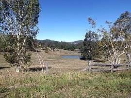 Paddocks along Sandy Creek Road, 2015 | |||||||||||||||
 Sandy Creek | |||||||||||||||
| Coordinates | 26°51′S 152°37′E / 26.850°S 152.617°ECoordinates: 26°51′S 152°37′E / 26.850°S 152.617°E | ||||||||||||||
| Population | 55 (2011 census)[1] | ||||||||||||||
| Postcode(s) | 4515 | ||||||||||||||
| LGA(s) | Somerset Region | ||||||||||||||
| State electorate(s) | Nanango | ||||||||||||||
| Federal Division(s) | Blair | ||||||||||||||
| |||||||||||||||
Sandy Creek is a locality in the Somerset Region, Queensland, Australia.[2] The locality had a population of 555 at the 2011 Australian Census.[1] Many parts of Sandy Creek are elevated along the southern Conondale Range and some of the range is protected within Bellthorpe National Park including Mount Mary Smokes.
References
- 1 2 Australian Bureau of Statistics (31 October 2012). "Sandy Creek (State Suburb))". 2011 Census QuickStats. Retrieved 12 August 2015.

- ↑ "Sandy Creek - Locality Bounded". Queensland Place Names Search. The State of Queensland. Retrieved 12 August 2015.
External links
![]()
This article is issued from
Wikipedia.
The text is licensed under Creative Commons - Attribution - Sharealike.
Additional terms may apply for the media files.