Coolana, Queensland
| Coolana Somerset Region, Queensland | |||||||||||||||
|---|---|---|---|---|---|---|---|---|---|---|---|---|---|---|---|
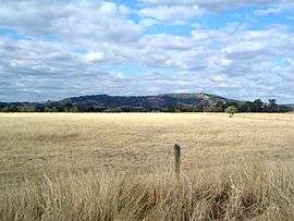 Mount Stradbroke and paddocks along Rassmussan Road, 2014 | |||||||||||||||
 Coolana | |||||||||||||||
| Coordinates | 27°31′04″S 152°33′08″E / 27.51778°S 152.55222°ECoordinates: 27°31′04″S 152°33′08″E / 27.51778°S 152.55222°E | ||||||||||||||
| Population | 174 (2011 census)[1] | ||||||||||||||
| Postcode(s) | 4311 | ||||||||||||||
| LGA(s) | Somerset Region | ||||||||||||||
| State electorate(s) | Lockyer | ||||||||||||||
| Federal Division(s) | Dickson | ||||||||||||||
| |||||||||||||||
Coolana is a rural suburb of Somerset Region, Queensland, Australia. At the 2011 Australian Census Coolana recorded a population of 174.[1]
Coolana lies in the west of the Lockyer Creek catchment area. Part of the northern boundary of Coolana follows Plain Creek at tributary of Lockyer Creek. The east of the suburb rises towards the peak of Mount Stradbroke. Lowood Minden Road traveses the locality from north to south. Parts of the area are used for agriculture while much of the land is undeveloped.
References
- 1 2 Australian Bureau of Statistics (31 October 2012). "Coolana (State Suburb)". 2011 Census QuickStats. Retrieved 9 August 2014.

External links
![]()
This article is issued from
Wikipedia.
The text is licensed under Creative Commons - Attribution - Sharealike.
Additional terms may apply for the media files.