Soumagne
| Soumagne | |
|---|---|
| Municipality | |
 | |
 Soumagne Location in Belgium
Location of Soumagne in Liège province  | |
| Coordinates: 50°37′N 05°45′E / 50.617°N 5.750°ECoordinates: 50°37′N 05°45′E / 50.617°N 5.750°E | |
| Country | Belgium |
| Community | French Community |
| Region | Wallonia |
| Province | Liège |
| Arrondissement | Liège |
| Government | |
| • Mayor | Chantal Daniel |
| • Governing party/ies | Independent |
| Area | |
| • Total | 27.14 km2 (10.48 sq mi) |
| Population (1 January 2017)[1] | |
| • Total | 16,798 |
| • Density | 620/km2 (1,600/sq mi) |
| Postal codes | 4630-4633 |
| Area codes | 04 |
| Website | www.soumagne.be |
Soumagne is a municipality of Belgium. It lies in the country's Walloon Region and Province of Liege. On September 1, 2008, Soumagne had a total population of 15,894.[2] The total area is 27.14 km2 which gives a population density of 585 inhabitants per km2.
The actual Soumagne is made of several municipalities that were merged in 1977 during the reorganization of the Belgian territory:
- Ayeneux
- Cerexhe-Heuseux
- Évegnée-Tignée
- Mélen
- Micheroux
- Soumagne
History
From the end of the 19th century until the 1960s, due to a lot of coal mines and a large production factory (called "Cooperative"), Soumagne was a flourishing municipality. After the end of coal mining, the mines were cleaned and residences as well as shopping areas were built on. Some buildings are kept and transformed into tourism activities (such as "le domaine du Bas-Bois").
Since 1980, due to the higher number of people leaving big cities (Liège and Verviers) to more rural municipalities, and due to the highway E40 (European route E40) passing on its territory, Soumagne recovers from the loss of coal mining and the end of the "Cooperative". In that period, houses are built due to a new, and young, population settling down in Soumagne. A lot of new shops and commercial centers are opened and small companies are emerging.
Attractions
There are a few touristic points in Soumange (among others):
- the Evegnée fountain (natural fountain in a rural landscape)
- Saint-Lambert church (built during the 13th century, burnt in 1694 and rebuilt)
- "Domaine du Bas-Bois" (a former coal mine site)
- Wégimont Castle (14th century construction changed through the centuries with a park transformed into a family amusement area)

See also
References
- ↑ Population per municipality as of 1 January 2017 (XLS; 397 KB)
- ↑ Direction Generale Institutions et Population, "Archived copy" (PDF). Archived from the original (PDF) on 2009-04-19. Retrieved 2009-04-19.
External links

- Domaine Provincial de Wégimont (in French)
Municipalities of the Province of Liège | ||
|---|---|---|
| Huy | 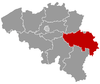 | |
| Liège | ||
| Verviers | ||
| Waremme | ||