Sonargaon Upazila
| Sonargaon সোনারগাঁও | |
|---|---|
| Upazila | |
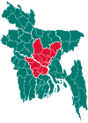
 Sonargaon Location in Bangladesh | |
| Coordinates: 23°39.5′N 90°36.5′E / 23.6583°N 90.6083°ECoordinates: 23°39.5′N 90°36.5′E / 23.6583°N 90.6083°E | |
| Country |
|
| Division | Dhaka Division |
| District | Narayanganj District |
| Area | |
| • Total | 171.66 km2 (66.28 sq mi) |
| Population (1991) | |
| • Total | 261,881 |
| • Density | 1,500/km2 (4,000/sq mi) |
| Time zone | UTC+6 (BST) |
| Website | Official Map of Sonargaon |
Sonargaon (Bengali: সোনারগাঁও) is an Upazila of Narayanganj District[1] in the Division of Dhaka, Bangladesh.
Demographics
As of the 1991 Bangladesh census, Sonargaon has a population of 261,881 in 44,405 households. Males constitute 52.11% of the population, and females 47.89%. The population over 18 years of age is 118,319.
Sonargaon has an average literacy rate of 33.1% (7+ years), compared with the national average of 32.4%.[2]
Food
Local food includes Gurer Zilapi, Murali, Binni Khoi, Shwandesh, etc.
Administration
Sonargaon has 11 Unions/Wards, 354 Mauzas/Mahallas, and 473 villages.
See also
References
- ↑ Shamsuddoha Chowdhury (2012), "Sonargaon Upazila", in Sirajul Islam and Ahmed A. Jamal, Banglapedia: National Encyclopedia of Bangladesh (Second ed.), Asiatic Society of Bangladesh
- ↑ "Population Census Wing, BBS". Archived from the original on 2005-03-27. Retrieved November 10, 2006.
| Upazila/Thana: | ||
|---|---|---|
This article is issued from
Wikipedia.
The text is licensed under Creative Commons - Attribution - Sharealike.
Additional terms may apply for the media files.