Sadarpur Upazila
| Sadarpur সদরপুর | |
|---|---|
| Upazila | |
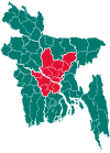
 Sadarpur Location in Bangladesh | |
| Coordinates: 23°28.6′N 90°2′E / 23.4767°N 90.033°ECoordinates: 23°28.6′N 90°2′E / 23.4767°N 90.033°E | |
| Country |
|
| Division | Dhaka Division |
| District | Faridpur District |
| Area | |
| • Total | 290.21 km2 (112.05 sq mi) |
| Population (2011) | |
| • Total | 193,347 |
| • Density | 670/km2 (1,700/sq mi) |
| Time zone | UTC+6 (BST) |
| Website | Website of Sadarpur |
Sadarpur (Bengali: সদরপুর) is an Upazila of Faridpur District in the Division of Dhaka, Bangladesh.[1]
Geography
Sadarpur is located at 23°28′35″N 90°02′00″E / 23.4764°N 90.0333°E and has 40219 households and total area 290.21 km².
Demographics
As of the 2011 Bangladesh census, Sadarpur has a population of 193347. Males constitute 48.14% of the population, and females 51.86%. Sadarpur has an average literacy rate of 43.20% (7+ years), and the national average of 32.4% literate.[2]
Administration
Sadarpur has 9 Unions/Wards, 89 Mauzas/Mahallas, and 287 villages.postal code 7820
See also
References
- ↑ Reza, Masud (2012). "Sadarpur Upazila". In Islam, Sirajul; Jamal, Ahmed A. Banglapedia: National Encyclopedia of Bangladesh (Second ed.). Asiatic Society of Bangladesh.
- ↑ "Population Census Wing, BBS". Archived from the original on 27 March 2005. Retrieved 10 November 2006.
| Upazila/Thana: | ||
|---|---|---|
This article is issued from
Wikipedia.
The text is licensed under Creative Commons - Attribution - Sharealike.
Additional terms may apply for the media files.