Kapasia Upazila
| Kapasia কাপাসিয়া | |
|---|---|
| Upazila | |
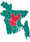
 Kapasia Location in Bangladesh | |
| Coordinates: 24°6′N 90°34.2′E / 24.100°N 90.5700°ECoordinates: 24°6′N 90°34.2′E / 24.100°N 90.5700°E | |
| Country |
|
| Division | Dhaka Division |
| District | Gazipur District |
| Government | |
| Area | |
| • Total | 356.98 km2 (137.83 sq mi) |
| Population (1991) | |
| • Total | 303,710 |
| • Density | 851/km2 (2,200/sq mi) |
| Time zone | UTC+6 (BST) |
| Website | Official Website of Kapasia Upazila |
Kapasia (Bengali: কাপাসিয়া) is an Upazila of Gazipur District in the Division of Dhaka, Bangladesh.[1]
Kapasia is located at 24°06′00″N 90°34′15″E / 24.1000°N 90.5708°E. Kapasia is a part of the old Bhawal Estate and falls within its boundary.
Demographics
According to the 1991 Bangladesh census, Kapasia had a population of 303,710, of whom 154,204 were aged 18 or over. Males constituted 50.83% of the population, and females 49.17%. Kapasia has an average literacy rate of 37% (7+ years), against the national average of 32.4%.[2]
Agriculture and outputs
Kapasia is a part of Gazipur District's Agricultural Area. Fishery is also popular along with farming. There has been an earlier project in Kapasia Upazila where the WorldFish Center with funding from the International Fund for Agricultural Development (IFAD) and the Danish International Development Agency (Danida), had researched on farming systems and had introduced adaptive integrated aquaculture practices.[3]
See also
References
- ↑ Islam, Md Nazrul (2012). "Kapasia Upazila". In Islam, Sirajul; Jamal, Ahmed A. Banglapedia: National Encyclopedia of Bangladesh (Second ed.). Asiatic Society of Bangladesh.
- ↑ "Population Census Wing, BBS". Archived from the original on 2005-03-27. Retrieved November 10, 2006.
- ↑ "Aqua and Agriculture".