Snow Hill Island
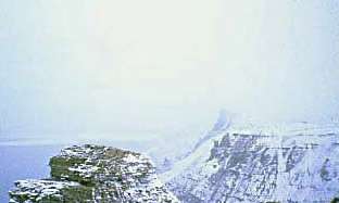 Snow Hill Island, January 1999 | |
 Snow Hill Island Location in Antarctica | |
| Geography | |
|---|---|
| Location | Antarctica |
| Coordinates | 64°28′S 57°12′W / 64.467°S 57.200°WCoordinates: 64°28′S 57°12′W / 64.467°S 57.200°W |
| Archipelago | James Ross Island group |
| Length | 33 km (20.5 mi) |
| Width | 12 km (7.5 mi) |
| Administration | |
| Administered under the Antarctic Treaty System | |
| Demographics | |
| Population | Native Penguins |
Snow Hill Island is an almost completely snowcapped island, 33 km (21 mi) long and 12 km (7.5 mi) wide, lying off the east coast of the Antarctic Peninsula. It is separated from James Ross Island to the north-east by Admiralty Sound and from Seymour Island to the north by Picnic Passage. It is one of several islands around the peninsula known as Graham Land, which is closer to South America than any other part of the Antarctic continent.[1]
History
The island was discovered on 6 January 1843 by a British expedition under James Clark Ross who, uncertain of its connection with the mainland, named it Snow Hill because its snow cover stood out in contrast to the bare ground of nearby Seymour Island. Its insular character was determined in 1902 by the Swedish Antarctic Expedition in the ship Antarctic, under Otto Nordenskiöld, who spent the winters of 1901, 1902, and 1903 there, using it as a base to explore the neighbouring islands and the Nordenskjold Coast of the Antarctic Peninsula.[2]
Historic site

The wooden hut built by the main party of the Swedish Expedition in February 1902, also known as Nordenskiöld House, has been designated a Historic Site or Monument (HSM 38), following a proposal by Argentina and the United Kingdom to the Antarctic Treaty Consultative Meeting.[3]
Geography
Ice-free Spath Peninsula, 4.0 mi (6.5 km) long, forms the island's northeast extremity.[4] The northernmost point of Snow Hill Island is Cape Lázara. The cape was named "Cabo Costa Lázara" by the command of the Argentine ship Chiriguano of the Argentine Antarctic Expedition, 1953–54, after Teniente (lieutenant) Costa Lázara, an Argentine navy pilot who was killed in a flying accident at the Espora Naval Air Base.[5][6]
Haslum Crag is a prominent rock crag close to the island's north coast. It stands 2 nautical miles (4 km) northeast of ice-free Station Nunatak, which rises 150 m (490 ft) tall. They were first seen by members of the Swedish Antarctic Expedition (SAE), 1901–04, under Otto Nordenskiöld, and surveyed by the Falkland Islands Dependencies Survey in 1952.[7][8] Nordenskiöld named Station Nunatak because of its proximity to the expedition's winter station, and he gave Haslum Crag its original name, "Basaltspitze".[8] Concerned that "Basaltspitze" could be mistaken for descriptive information, the United Kingdom Antarctic Place-Names Committee changed it to Haslum Crag, honoring H.J. Haslum, second mate on the Antarctic, the ship of the Swedish expedition.[7]
Day Nunatak and Dingle Nunatak appear within the main ice cap of the island. Both were named by the UK Antarctic Place-Names Committee in 1995. Day Ninatak was named for Crispin Mark Jeremy Day, a long-serving British Antarctic Survey (BAS) General Field Assistant. He was at Rothera Station, 1986–89, 1991–92, 1993–94; and was a member of the BAS field party in the James Ross Island area from 1994–95.[9] Dingle Nunatak was named for Richard Vernon Dingle, Senior BAS geologist, and a member of the BAS field party in the James Ross Island area from 1994–95.[10]
Sanctuary Cliffs is a rock cliffs at the north edge of the island's central ice cap. It was first surveyed by the SAE, which named them "Mittelnunatak," presumably because of their position near the middle of the north coast of the island. Following survey by FIDS in 1952, it was reported that the term "cliffs" was more suitable than "nunatak" for this feature. UK-APC recommended an entirely new and more distinctive name be approved, and it was dubbed Sanctuary Cliffs in recognition of the way the cliffs provide shelter from the prevailing southwesterly winds.[11]
Important Bird Area
A site at the south-western extremity of the island, comprising 263 ha of sea ice adjacent to the coast, has been identified as an Important Bird Area (IBA) by BirdLife International because it supports a breeding colony of about 4000 pairs of emperor penguins. It is one of only two such colonies on land in the Antarctic Peninsula region, the other being that at the Dion Islands.[12]
See also
References
- ↑ ESA Science & Technology: Graham Land
- ↑ Stonehouse (2002)
- ↑ "List of Historic Sites and Monuments approved by the ATCM (2012)" (PDF). Antarctic Treaty Secretariat. 2012. Retrieved 2013-12-31.
- ↑ "Spath Peninsula". Geographic Names Information System. United States Geological Survey. Retrieved 2018-08-30.
- ↑ "Cape Lázara". Geographic Names Information System. United States Geological Survey. Retrieved 2013-06-06.
- ↑ Alberts, Fred G., ed. (June 1995). Geographic Names of the Antarctic (PDF) (second ed.). United States Board on Geographic Names. p. 424. Retrieved 2012-04-05.
- 1 2 "Haslum Crag". Geographic Names Information System. United States Geological Survey. Retrieved 2012-05-30.
- 1 2 "Station Nunatak". Geographic Names Information System. United States Geological Survey. Retrieved 2018-08-30.
- ↑ "Day Nunatak". Geographic Names Information System. United States Geological Survey. Retrieved 2018-08-30.
- ↑ "Dingle Nunatak". Geographic Names Information System. United States Geological Survey. Retrieved 2018-08-30.
- ↑ "Sanctuary Cliffs". Geographic Names Information System. United States Geological Survey. Retrieved 2018-08-30.
- ↑ "Snow Hill Island". BirdLife data zone: Important Bird Areas. BirdLife International. 2013. Retrieved 2013-01-19.
Further reading
- Antarctica. Sydney: Reader's Digest, 1985, pp. 152–159..
- Child, Jack. Antarctica and South American Geopolitics: Frozen Lebensraum. New York: Praeger Publishers, 1988, pp. 69, 72.
- Lonely Planet, Antarctica: a Lonely Planet Travel Survival Kit, Oakland, CA: Lonely Planet Publications, 1996, 307.
- Stewart, Andrew, Antarctica: An Encyclopedia. London: McFarland and Co., 1990 (2 volumes), p 931.
- Stonehouse, Bernard. Encyclopedia of Antarctica and the Southern Oceans, John Wiley and Sons, 2002. ISBN 0-471-98665-8
- U.S. National Science Foundation, Geographic Names of the Antarctic, Fred G. Alberts, ed. Washington: NSF, 1980.
![]()
| Authority control |
|---|