Smith Township, Whitley County, Indiana
| Smith Township | |
|---|---|
| Township | |
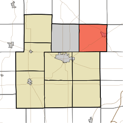 Location in Whitley County | |
| Coordinates: 41°13′22″N 85°22′05″W / 41.22278°N 85.36806°WCoordinates: 41°13′22″N 85°22′05″W / 41.22278°N 85.36806°W | |
| Country | United States |
| State | Indiana |
| County | Whitley |
| Government | |
| • Type | Indiana township |
| Area | |
| • Total | 35.3 sq mi (91 km2) |
| • Land | 34.93 sq mi (90.5 km2) |
| • Water | 0.37 sq mi (1.0 km2) 1.05% |
| Elevation[1] | 856 ft (261 m) |
| Population (2010) | |
| • Total | 5,327 |
| • Density | 152.5/sq mi (58.9/km2) |
| Time zone | UTC-5 (Eastern (EST)) |
| • Summer (DST) | UTC-4 (EDT) |
| Area code(s) | 260 |
| GNIS feature ID | 453853 |
Smith Township is one of nine townships in Whitley County, Indiana, United States. As of the 2010 census, its population was 5,327 and it contained 2,244 housing units.[2]
Geography
According to the 2010 census, the township has a total area of 35.3 square miles (91 km2), of which 34.93 square miles (90.5 km2) (or 98.95%) is land and 0.37 square miles (0.96 km2) (or 1.05%) is water.[2] Lakes in this township include Blue Lake, Devil Lake, Devils Lake and Little Lake. The stream of Mud Run runs through this township.
Cities and towns
Unincorporated towns
(This list is based on USGS data and may include former settlements.)
Adjacent townships
- Green Township, Noble County (north)
- Swan Township, Noble County (northeast)
- Eel River Township, Allen County (east)
- Lake Township, Allen County (southeast)
- Union Township (south)
- Thorncreek Township (west)
- Noble Township, Noble County (northwest)
Cemeteries
The township contains three cemeteries: Concord, Garrison and Jeffries.
Major highways
Education
Smith Township residents may obtain a free library card from the Churubusco Public Library.[3]
References
- ↑ "US Board on Geographic Names". United States Geological Survey. October 25, 2007. Retrieved 2017-05-08.
- 1 2 "Population, Housing Units, Area, and Density: 2010 - County -- County Subdivision and Place -- 2010 Census Summary File 1". United States Census. Retrieved 2013-05-10.
- ↑ "Who We Are". Churubusco Public Library. Retrieved 17 March 2018.
External links
Municipalities and communities of Whitley County, Indiana, United States | ||
|---|---|---|
| City | ||
| Towns | ||
| Townships | ||
| CDP | ||
| Other unincorporated communities | ||
| Footnotes | ‡This populated place also has portions in an adjacent county or counties | |
This article is issued from
Wikipedia.
The text is licensed under Creative Commons - Attribution - Sharealike.
Additional terms may apply for the media files.