Collins, Indiana
| Collins, Indiana | |
|---|---|
| Unincorporated community | |
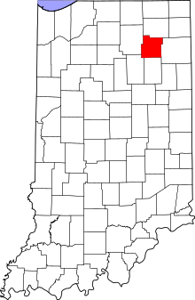 Whitley County's location in Indiana | |
 Collins Location of Collins in Whitley County | |
| Coordinates: 41°11′51″N 85°23′12″W / 41.19750°N 85.38667°WCoordinates: 41°11′51″N 85°23′12″W / 41.19750°N 85.38667°W | |
| Country | United States |
| State | Indiana |
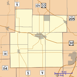
| County | Whitley |
| Township | Smith |
| Elevation[1] | 863 ft (263 m) |
| Time zone | UTC-5 (Eastern (EST)) |
| • Summer (DST) | UTC-4 (EDT) |
| ZIP code | 46725 |
| Area code(s) | 260 |
| FIPS code | 18-14518[2] |
| GNIS feature ID | 432790 |
Collins is an unincorporated community in Smith Township, Whitley County, in the U.S. state of Indiana.[3] It is commonly referred to as a 'ghost town', however this is untrue; Collins just has a very low population and contains an abandoned school.
History
Collins was platted in 1872, and was named after James Collins, a railroad official.[4]
A post office was established at Collins in 1872, and remained in operation until it was discontinued in 1913.[5]
Geography
Collins is located at 41°11′51″N 85°23′12″W / 41.19750°N 85.38667°W.
References
- ↑ "US Board on Geographic Names". United States Geological Survey. October 25, 2007. Retrieved 2016-07-05.
- ↑ "American FactFinder". United States Census Bureau. Archived from the original on 2013-09-11. Retrieved 2008-01-31.
- ↑ "Collins, Indiana". Geographic Names Information System. United States Geological Survey. Retrieved July 24, 2017.
- ↑ Baker, Ronald L. (October 1995). From Needmore to Prosperity: Hoosier Place Names in Folklore and History. Indiana University Press. p. 100. ISBN 978-0-253-32866-3.
...platted in 1872 and named for James Collins, president of the Detroit, Eel River, and Illinois Railroad.
- ↑ "Whitley County". Jim Forte Postal History. Retrieved 5 July 2016.
Municipalities and communities of Whitley County, Indiana, United States | ||
|---|---|---|
| City | ||
| Towns | ||
| Townships | ||
| CDP | ||
| Other unincorporated communities | ||
| Footnotes | ‡This populated place also has portions in an adjacent county or counties | |
This article is issued from
Wikipedia.
The text is licensed under Creative Commons - Attribution - Sharealike.
Additional terms may apply for the media files.