Union Township, Whitley County, Indiana
| Union Township | |
|---|---|
| Township | |
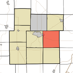 Location in Whitley County | |
| Coordinates: 41°07′59″N 85°23′44″W / 41.13306°N 85.39556°WCoordinates: 41°07′59″N 85°23′44″W / 41.13306°N 85.39556°W | |
| Country | United States |
| State | Indiana |
| County | Whitley |
| Government | |
| • Type | Indiana township |
| Area | |
| • Total | 36.99 sq mi (95.8 km2) |
| • Land | 36.95 sq mi (95.7 km2) |
| • Water | 0.04 sq mi (0.1 km2) 0.11% |
| Elevation[1] | 833 ft (254 m) |
| Population (2010) | |
| • Total | 2,244 |
| • Density | 60.7/sq mi (23.4/km2) |
| Time zone | UTC-5 (Eastern (EST)) |
| • Summer (DST) | UTC-4 (EDT) |
| Area code(s) | 260 |
| GNIS feature ID | 453940 |
Union Township is one of nine townships in Whitley County, Indiana, United States. As of the 2010 census, its population was 2,244 and it contained 884 housing units.[2]
Geography
According to the 2010 census, the township has a total area of 36.99 square miles (95.8 km2), of which 36.95 square miles (95.7 km2) (or 99.89%) is land and 0.04 square miles (0.10 km2) (or 0.11%) is water.[2] The stream of Emerick Branch runs through this township.
Cities and towns
- Columbia City (east edge)
Unincorporated towns
- Coesse at 41°07′40″N 85°23′43″W / 41.1278248°N 85.3952547°W
- Coesse Corners at 41°08′24″N 85°23′45″W / 41.1400470°N 85.3958103°W
(This list is based on USGS data and may include former settlements.)
Adjacent townships
- Smith Township (north)
- Lake Township, Allen County (east)
- Aboite Township, Allen County (southeast)
- Jefferson Township (south)
- Washington Township (southwest)
- Columbia Township (west)
- Thorncreek Township (northwest)
Cemeteries
The township contains two cemeteries, Union Township Cemetery (NE corner of US 30 and 500 E) and Lutheran Cemetery on Lincoln Way just East of 600 E.
Major highways
Airports and landing strips
- Gordon Airport
References
- ↑ "US Board on Geographic Names". United States Geological Survey. October 25, 2007. Retrieved 2017-05-08.
- 1 2 "Population, Housing Units, Area, and Density: 2010 - County -- County Subdivision and Place -- 2010 Census Summary File 1". United States Census. Retrieved 2013-05-10.
External links
Municipalities and communities of Whitley County, Indiana, United States | ||
|---|---|---|
| City | ||
| Towns | ||
| Townships | ||
| CDP | ||
| Other unincorporated communities | ||
| Footnotes | ‡This populated place also has portions in an adjacent county or counties | |
This article is issued from
Wikipedia.
The text is licensed under Creative Commons - Attribution - Sharealike.
Additional terms may apply for the media files.