Jefferson Township, Whitley County, Indiana
| Jefferson Township | |
|---|---|
| Township | |
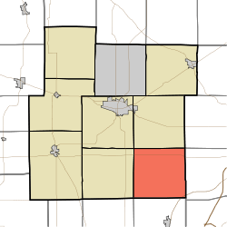 Location in Whitley County | |
| Coordinates: 41°02′40″N 85°24′11″W / 41.04444°N 85.40306°WCoordinates: 41°02′40″N 85°24′11″W / 41.04444°N 85.40306°W | |
| Country | United States |
| State | Indiana |
| County | Whitley |
| Government | |
| • Type | Indiana township |
| Area | |
| • Total | 35.08 sq mi (90.9 km2) |
| • Land | 35.08 sq mi (90.9 km2) |
| • Water | 0 sq mi (0 km2) 0% |
| Elevation[1] | 850 ft (259 m) |
| Population (2010) | |
| • Total | 2,182 |
| • Density | 62.2/sq mi (24.0/km2) |
| Time zone | UTC-5 (Eastern (EST)) |
| • Summer (DST) | UTC-4 (EDT) |
| Area code(s) | 260 |
| GNIS feature ID | 453504 |
Jefferson Township is one of nine townships in Whitley County, Indiana, United States. As of the 2010 census, its population was 2,182 and it contained 888 housing units.[2]
Geography
According to the 2010 census, the township has a total area of 35.08 square miles (90.9 km2), all land.[2]
Unincorporated towns
- Dunfee at 41°05′12″N 85°20′14″W / 41.0867140°N 85.3371973°W
- Raber at 41°05′09″N 85°25′58″W / 41.0858799°N 85.4327550°W
- Saturn at 41°02′05″N 85°21′20″W / 41.0347692°N 85.3555305°W
(This list is based on USGS data and may include former settlements.)
Adjacent townships
- Union Township (north)
- Lake Township, Allen County (northeast)
- Aboite Township, Allen County (east)
- Jackson Township, Huntington County (south)
- Clear Creek Township, Huntington County (southwest)
- Washington Township (west)
- Columbia Township (northwest)
Cemeteries
The township contains two cemeteries: Bayliss and Broxon.
Major highways
Airports and landing strips
- Homestead Airport
References
- "Jefferson Township, Whitley County, Indiana". Geographic Names Information System. United States Geological Survey. Retrieved 2009-09-24.
- United States Census Bureau cartographic boundary files
- ↑ "US Board on Geographic Names". United States Geological Survey. October 25, 2007. Retrieved 2017-05-08.
- 1 2 "Population, Housing Units, Area, and Density: 2010 - County -- County Subdivision and Place -- 2010 Census Summary File 1". United States Census. Retrieved 2013-05-10.
External links
Municipalities and communities of Whitley County, Indiana, United States | ||
|---|---|---|
| City | ||
| Towns | ||
| Townships | ||
| CDP | ||
| Other unincorporated communities | ||
| Footnotes | ‡This populated place also has portions in an adjacent county or counties | |
This article is issued from
Wikipedia.
The text is licensed under Creative Commons - Attribution - Sharealike.
Additional terms may apply for the media files.