Slieve True
| Slieve True (Sliabh an Triúir) | |
|---|---|
| Highest point | |
| Elevation | 312 m (1,024 ft) [1] |
| Prominence | 189 m (620 ft) [1] |
| Listing | Marilyn |
| Coordinates | 54°43′55″N 5°54′35″W / 54.731825°N 5.909761°WCoordinates: 54°43′55″N 5°54′35″W / 54.731825°N 5.909761°W |
| Naming | |
| Translation | Hill of the three (Irish) |
| Geography | |
| Location | County Antrim, Northern Ireland |
| OSI/OSNI grid | J347891 |
| Topo map | OSNI Discoverer 29 |
Slieve True or Slievetrue (from Irish Sliabh an Triúir, meaning 'hill of the three')[1] is a 312 m-high (1,024 ft) hill in County Antrim, Northern Ireland. It is near Knockagh Monument and Monkstown, about 6 km (3.7 mi) north of Belfast.
Slieve True derives its name from three standing stones (known as "The Three Brothers") about one-half mile (0.80 km) southwest of the summit.[1] These have since been integrated into a field wall. There is also a cairn in the area.[2]
In May 2013, Irish electricity company Gaelectric opened a wind farm in the Carn Hill area of Slievetrue, consisting of six wind turbines at a total cost of £20 million.
References
- 1 2 3 4 http://mountainviews.ie/mv/index.php
- ↑ "Lewis' Topographical Directory of Ireland". Retrieved 2009-04-24.

Mountains and hills of Ulster | ||
|---|---|---|
| Antrim Hills | 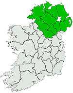 | |
| Antrim Plateau | ||
| Belfast Hills | ||
| Breifne | ||
| Croaghgorms | ||
| Derryveagh | ||
| Inishowen | ||
| Mournes | ||
| Sperrins | ||
| Southwest Donegal | ||
| Others | ||
This article is issued from
Wikipedia.
The text is licensed under Creative Commons - Attribution - Sharealike.
Additional terms may apply for the media files.