Magheramorne

Magheramorne (from Irish: Machaire Morna)[1] is a hamlet in County Antrim, Northern Ireland. It is about 5 miles south of Larne on the shores of Larne Lough. It had a population of 75 people in the 2001 Census. Following the reform of Northern Ireland's local government system on 1 April 2015, Magheramorne lies within the Mid and East Antrim Borough Council area.
Industry
Nearby is an old limestone quarry currently owned by Lafarge (formerly known as Blue Circle). Extraction of limestone from the quarry, for use in the Magheramorne cement plant, ceased in 1980.[2] The high point for limestone extraction at Magheramorne was in the 19th and 20th centuries. In the 19th century a mission church for labourers at the limeworks was established and became a Presbyterian Church.
In September 2009, Lafarge obtained outline planning permission for redevelopment of the quarry and cement works, including a new eco-friendly village and a major cycling centre mainly in the quarry.[2] A regeneration plan will transform the quarry into a nature conservation, leisure and housing area. The 75 hectare quarry will be the home of a World Cycling Centre and the All-Ireland Scuba Diving Centre if the plans go ahead.[3] The area of Larne Lough that was used to ship cement out of Magheramorne is now used as a marina.
Game of Thrones
The abandoned Magheramorne quarry area is used as a filming location for the HBO TV series Game of Thrones. Castle Black, Hardhome and The Wall were filmed there, and battlements were built there to serve as King's Landing's defences during the Battle of Blackwater Bay;[4] scenes shot atop the wall were filmed inside the Paint Hall Studios in Belfast. The composite set (with both exteriors and interiors) consisted of a large section of Castle Black including the courtyard, the ravenry, the mess hall and the barracks, and used the stone wall of the quarry as the basis for the ice wall that protects Westeros. A functional elevator was built to lift the rangers to the top of The Wall. A castle with real rooms and a working elevator were built near a cliff 400 feet (120 m) high, CGI fills in the rest to make the wall appear 700 feet (210 m) high.[5] The area around the elevator was painted white to make it look like ice. George R. R. Martin said: "It's a pretty spectacular, yet miserable location. It is wet and rainy, and the mud is thick. I visited there; it really gets the actors in the mood of being at the end of the world in all of this cold and damp and chill".[6]
People
- Saint Comgall, founder of Bangor Abbey in County Down, was born at Magheramorne in the 6th century.[7]
- William McConnell of Magheramorne, who died at the age of 102, was one of the last living survivors of the 1916 Battle of the Somme.
Transport
- Magheramorne railway station was opened on 1 October 1862.[8]
Culture
- The area is home to the Magheramorne Silver Band, established in 1882 by one of the local Orange Lodges. The band has drawn its membership mainly from the Magheramorne area and surrounding district, including the town of Larne, and continues to undertake a wide range of engagements across East Antrim and further afield.[9]
Sport
- Newington Rangers F.C. play in the Northern Amateur Football League.
References
- ↑ Placenames Database of Ireland
- 1 2 "Local MP Visits Magheramorne Quarry". Magheramore: Reinvented. Larfarge Tarmac. Archived from the original on 12 July 2014. Retrieved 13 April 2015.
- ↑ Magheramorne reinvented by Lafarge Archived 2016-06-28 at the Wayback Machine.
- ↑ Game of Thrones Season 5: A Day in the Life. HBO. 8 February 2015. Retrieved 17 July 2017 – via YouTube.
- ↑ "Game of Thrones: 10 decrets about HBO's adaption". The Daily Beast. Retrieved 13 April 2015.
- ↑ "Travels to season 2 and beyond with Game of Thrones creator George R. R. Martin". Fodor's. Retrieved 13 April 2015.
- ↑ Sandford, Ernest (1976). Discover Northern Ireland. Belfast: Northern Ireland Tourist Board. p. 53. ISBN 0 9500222 7 6.
- ↑ "Magheramorne station" (PDF). Railscot - Irish Railways. Retrieved 2007-08-28.
- ↑ Magheramorne Silver Band Archived 2014-12-18 at the Wayback Machine.
External links
| Wikimedia Commons has media related to Magheramorne. |
Coordinates: 54°49′N 5°46′W / 54.817°N 5.767°W

| Volcanism | 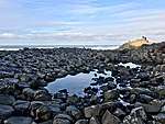 Basalt columns at Giant's Causeway | |
|---|---|---|
| Volcanic plugs | ||
| Dykes and Sills | ||
| Metamorphic | ||
| Sedimentary | ||
| Lists | ||