Sion-les-Mines
| Sion-les-Mines | ||
|---|---|---|
| Commune | ||
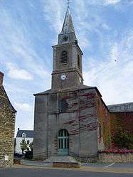 The church in Sion-les-Mines | ||
| ||
 Sion-les-Mines Location within Pays de la Loire region  Sion-les-Mines | ||
| Coordinates: 47°44′09″N 1°35′26″W / 47.7358°N 1.5906°WCoordinates: 47°44′09″N 1°35′26″W / 47.7358°N 1.5906°W | ||
| Country | France | |
| Region | Pays de la Loire | |
| Department | Loire-Atlantique | |
| Arrondissement | Châteaubriant-Ancenis | |
| Canton | Guémené-Penfao | |
| Intercommunality | secteur de Derval | |
| Government | ||
| • Mayor (2008–2014) | Joseph David | |
| Area1 | 54.71 km2 (21.12 sq mi) | |
| Population (2006)2 | 1,511 | |
| • Density | 28/km2 (72/sq mi) | |
| Demonym(s) | Sionnaises, Sionnais | |
| Time zone | UTC+1 (CET) | |
| • Summer (DST) | UTC+2 (CEST) | |
| INSEE/Postal code | 44197 /44590 | |
| Elevation | 17–88 m (56–289 ft) | |
| Website | http://www.mairie-sionlesmines.fr/ | |
|
1 French Land Register data, which excludes lakes, ponds, glaciers > 1 km2 (0.386 sq mi or 247 acres) and river estuaries. 2 Population without double counting: residents of multiple communes (e.g., students and military personnel) only counted once. | ||
.svg.png)
Sion-les-Mines is a commune in the Loire-Atlantique department in western France.
Geography
The river Chère flows westward through the commune.
See also
References
- Da Vinci Declassified, 2006 TLC video documentary
| Wikimedia Commons has media related to Sion-les-Mines. |
This article is issued from
Wikipedia.
The text is licensed under Creative Commons - Attribution - Sharealike.
Additional terms may apply for the media files.