La Chapelle-sur-Erdre
| La Chapelle-sur-Erdre | ||
|---|---|---|
| Commune | ||
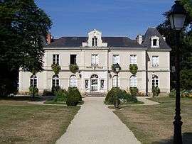 The town hall in La Chapelle-sur-Erdre | ||
| ||
 La Chapelle-sur-Erdre Location within Pays de la Loire region  La Chapelle-sur-Erdre | ||
| Coordinates: 47°17′59″N 1°33′06″W / 47.2997°N 1.5517°WCoordinates: 47°17′59″N 1°33′06″W / 47.2997°N 1.5517°W | ||
| Country | France | |
| Region | Pays de la Loire | |
| Department | Loire-Atlantique | |
| Arrondissement | Nantes | |
| Canton | La Chapelle-sur-Erdre | |
| Intercommunality | Nantes Métropole | |
| Government | ||
| • Mayor (2008–2014) | Fabrice Roussel (PS) | |
| Area1 | 33.42 km2 (12.90 sq mi) | |
| Population (2006)2 | 16,660 | |
| • Density | 500/km2 (1,300/sq mi) | |
| Demonym(s) | Chapelaine, Chapelain | |
| Time zone | UTC+1 (CET) | |
| • Summer (DST) | UTC+2 (CEST) | |
| INSEE/Postal code | 44035 /44240 | |
| Elevation | 1–57 m (3.3–187.0 ft) | |
| Website | www.lachapellesurerdre.fr | |
|
1 French Land Register data, which excludes lakes, ponds, glaciers > 1 km2 (0.386 sq mi or 247 acres) and river estuaries. 2 Population without double counting: residents of multiple communes (e.g., students and military personnel) only counted once. | ||

La Chapelle-sur-Erdre is a commune in the Loire-Atlantique department in western France.
See also
| Wikimedia Commons has media related to La Chapelle-sur-Erdre. |
This article is issued from
Wikipedia.
The text is licensed under Creative Commons - Attribution - Sharealike.
Additional terms may apply for the media files.