La Remaudière
| La Remaudière | ||
|---|---|---|
| Commune | ||
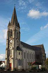 The church of Saint-Martin, in La Remaudière | ||
| ||
 La Remaudière Location within Pays de la Loire region  La Remaudière | ||
| Coordinates: 47°14′18″N 1°14′32″W / 47.2383°N 1.2422°WCoordinates: 47°14′18″N 1°14′32″W / 47.2383°N 1.2422°W | ||
| Country | France | |
| Region | Pays de la Loire | |
| Department | Loire-Atlantique | |
| Arrondissement | Nantes | |
| Canton | Vallet | |
| Intercommunality | Loire-Divatte | |
| Government | ||
| • Mayor (2008–2014) | Alan Coraud | |
| Area1 | 12.98 km2 (5.01 sq mi) | |
| Population (2006)2 | 1,047 | |
| • Density | 81/km2 (210/sq mi) | |
| Demonym(s) |
Remaudièrois, Remaudièroises Remaudois, Remaudoises | |
| Time zone | UTC+1 (CET) | |
| • Summer (DST) | UTC+2 (CEST) | |
| INSEE/Postal code | 44141 /44430 | |
| Elevation | 38–101 m (125–331 ft) | |
| Website | http://www.la-remaudiere.fr/ | |
|
1 French Land Register data, which excludes lakes, ponds, glaciers > 1 km2 (0.386 sq mi or 247 acres) and river estuaries. 2 Population without double counting: residents of multiple communes (e.g., students and military personnel) only counted once. | ||

La Remaudière is a commune in the Loire-Atlantique department in western France.
Sister cities
The following cities are twinned with La Remaudière:[1]


References
- ↑ "Ystävyyskuntatoiminta" (in Norwegian). City of Saarijärvi. Archived from the original on 2013-12-06. Retrieved 2012-06-01.
See also
| Wikimedia Commons has media related to La Remaudière. |
This article is issued from
Wikipedia.
The text is licensed under Creative Commons - Attribution - Sharealike.
Additional terms may apply for the media files.