Ligné, Loire-Atlantique
| Ligné Polinieg | ||
|---|---|---|
| Commune | ||
.jpg) The church of Saint-Pierre, in Ligné | ||
| ||
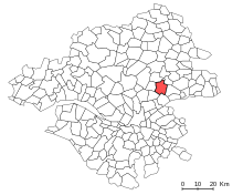
 Ligné Location within Pays de la Loire region  Ligné | ||
| Coordinates: 47°24′45″N 1°22′33″W / 47.4125°N 1.3758°WCoordinates: 47°24′45″N 1°22′33″W / 47.4125°N 1.3758°W | ||
| Country | France | |
| Region | Pays de la Loire | |
| Department | Loire-Atlantique | |
| Arrondissement | Châteaubriant-Ancenis | |
| Canton | Nort-sur-Erdre | |
| Intercommunality | Pays d'Ancenis | |
| Government | ||
| • Mayor (2014–2020) | Maurice Perrion | |
| Area1 | 45.41 km2 (17.53 sq mi) | |
| Population (2015)2 | 5,088 | |
| • Density | 110/km2 (290/sq mi) | |
| Demonym(s) | Lignéennes, Lignéens | |
| Time zone | UTC+1 (CET) | |
| • Summer (DST) | UTC+2 (CEST) | |
| INSEE/Postal code | 44082 /44850 | |
| Elevation | 12–72 m (39–236 ft) | |
| Website | http://www.ligne.fr/ | |
|
1 French Land Register data, which excludes lakes, ponds, glaciers > 1 km2 (0.386 sq mi or 247 acres) and river estuaries. 2 Population without double counting: residents of multiple communes (e.g., students and military personnel) only counted once. | ||
.svg.png)
Ligné is a commune in the Loire-Atlantique department in western France.
Location
The commune of Ligné is located 25km nord-east of Nantes, 17km north-west of Ancenis and 10km east of Nort-sur-Erdre. The bordering communes are Les Touches, Mouzeil, Couffé, Le Cellier, Saint-Mars-du-Désert and Petit-Mars.
Before 2015, Ligné was the capital of a canton that also included Couffé, Mouzeil and Le Cellier. The canton was split in 2015 and the commune joined the canton of Nort-sur-Erdre.
Etymology
The name of the locality was attested in the Latin form Lingiacum in 11231, Ligiacum in 1128 and Ligneium in 1277. In Breton, she was called Polinieg by the Office of the Breton Language, name without historical value.
History
Ligné extends over a height commonly referred to as "Ligné Plateau". This plateau forms the watershed between the Erdre and the Loire.
In the heart of the village, the chapel Saint-Mathurin (XIIIth Century) was the place of a great pilgrimage. After several damages throughout years, the chaptel has been renovated and transformed into a small exhibition center in 2012.
Governance, Culture, Education
List of successive mayors
| Period | Name | Political party | Occupation |
|---|---|---|---|
| 1834-1843 | Jean Ouairy | ||
| 1843-1848 | Julien David | ||
| 16 April 1848-5 November 1848 | Louis Ouairy "father" | ||
| 5 November 1848-14 June 1855 | Emmanuel Botte | ||
| 14 June 1855-12 October 1861 | Louis Ouairy "son" | ||
| 12 October 1861-1870 | Nicolas Kerbarh | ||
| 1870-1884 | Jean Rabu | ||
| 1884-1908 | Auguste du Ponceau | ||
| 1908-1922 | Gilbert de Ponsay | ||
| 1922-1925 | Gabriel de la Rochefordière | ||
| 1925-1954 | François du Rusquec | ||
| 1954-1965 | Gilbert Moinard | ||
| 1965-1969 | Louis Jourdon | ||
| 1969-1995 | Jean Robin | Miscellaneous right (DVD) | carpenter |
| 1995-current | Maurice Perrion | UDF, then MoDem, then AC, then UDI | Business Manager, Regional Councilor (7th Vice-President)
President of the Association of Mayors of Loire-Atlantique |
Twinning
The town of Lignée is twinned with Presteigne, Wales since 2004. Cultural exchanges and trips are regularly organized between the two cities.
Culture
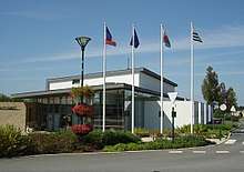

Ligné has a few cultural centers. "Le Préambule" is a multipurpose room opened since 2003 that is reconfigurable to host different types of events. Cultural programming is offered every year from September to May. Both rooms are also used to teach artistic practices. The Saint-Mathurin chaptel is since 2012 a small exhibition center dedicated to visual arts. The city also has a municipal library, as well as two sports complexes.
Education

With a young and growing population, Ligné offers a broad educational offer to its inhabitants. The city has two schools, one public and the other private and two high schools that follow the same principle.
Private schools are Notre-Dame primary school and Saint-Joseph High School, while public schools are Jules Verne primary school and Agnès Varda High School.
Agnès Varda College was inaugurated in 2011 and named in honor of the director of the same name. It welcomes more than 750 students.
Demographics
| Historical population | ||
|---|---|---|
| Year | Pop. | ±% p.a. |
| 1793 | 1,501 | — |
| 1821 | 2,052 | +1.12% |
| 1841 | 2,144 | +0.22% |
| 1861 | 2,331 | +0.42% |
| 1881 | 2,621 | +0.59% |
| 1901 | 2,618 | −0.01% |
| 1921 | 2,194 | −0.88% |
| 1946 | 1,864 | −0.65% |
| 1962 | 1,774 | −0.31% |
| 1975 | 1,662 | −0.50% |
| 1990 | 2,730 | +3.36% |
| 2005 | 3,682 | +2.01% |
| 2010 | 4,592 | +4.52% |
| 2015 | 5,088 | +2.07% |
| Source:Base Cassini from EHESS for figures until 1990[1][2] + INSEE | ||
According to the classification established by INSEE, Ligné is an isolated city that is part of the urban area and the employment zone of Nantes and the living area of Nort-sur-Erdre. According to INSEE, in 2010, the distribution of the population in the territory of the municipality was considered as "sparse": 94% of inhabitants lived in "sparsely populated" areas and 6% in "very sparsely populated" areas.
The town benefits greatly from the growing attractiveness of Nantes since the nineties. Indeed, the population almost doubled since 1990. This demographic growth is reflected in the construction of new residential neighborghood and infrastructures to welcome this new population.
The following data relate to the year 2013. The population of the municipality is relatively young. The rate of people aged over 60 (15.7%) is indeed lower than the national rate (22.6%) and the county rate (22.5%). In fact, 41.2% of women and 42.6% of men residing in Ligné are under 30 years of age.
See also
- Communes of the Loire-Atlantique department
- Loire-Atlantique
- Canton of Nort-sur-Erdre
- Canton of Ligné
- Arrondissement of Châteaubriant-Ancenis
- Pays-de-la-Loire
| Wikimedia Commons has media related to Ligné (Loire-Atlantique). |