Chère
| Chère | |
|---|---|
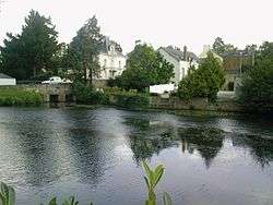 The Chère at Châteaubriant. | |
| Country | France |
| Physical characteristics | |
| Main source |
Soudan 80 m (260 ft) 47°42′01″N 01°17′25″W / 47.70028°N 1.29028°W |
| River mouth |
Vilaine 3 m (9.8 ft) 47°42′25″N 01°50′13″W / 47.70694°N 1.83694°WCoordinates: 47°42′25″N 01°50′13″W / 47.70694°N 1.83694°W |
| Length | 65.1 km (40.5 mi) |
| Discharge |
|
| Basin features | |
| Progression | Vilaine→ Atlantic Ocean |
| Basin size | 390 km2 (150 sq mi) |
The Chère (French: la Chère) is a 65.1 km (40.5 mi) long river in the Loire-Atlantique and Ille-et-Vilaine départements, western France.[1] Its source is at Soudan. It flows generally west. It is a left tributary of the Vilaine into which it flows between Pierric and Sainte-Anne-sur-Vilaine.
Communes along its course
This list is ordered from source to mouth:
- Loire-Atlantique: Soudan, Châteaubriant, Rougé, Saint-Aubin-des-Châteaux, Sion-les-Mines, Mouais, Derval,
- Ille-et-Vilaine: Grand-Fougeray,
- Loire-Atlantique: Pierric,
- Ille-et-Vilaine: Sainte-Anne-sur-Vilaine
Notes
| Wikimedia Commons has media related to Chère. |
References
This article is issued from
Wikipedia.
The text is licensed under Creative Commons - Attribution - Sharealike.
Additional terms may apply for the media files.