Pouillé-les-Côteaux
| Pouillé-les-Coteaux Paolieg-ar-Rozioù | |
|---|---|
| Commune | |
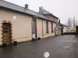 The town hall in Pouillé-les-Côteaux | |
 Pouillé-les-Coteaux Location within Pays de la Loire region  Pouillé-les-Coteaux | |
| Coordinates: 47°27′22″N 1°09′39″W / 47.4561°N 1.1608°WCoordinates: 47°27′22″N 1°09′39″W / 47.4561°N 1.1608°W | |
| Country | France |
| Region | Pays de la Loire |
| Department | Loire-Atlantique |
| Arrondissement | Châteaubriant-Ancenis |
| Canton | Ancenis |
| Intercommunality | Pays d'Ancenis |
| Government | |
| • Mayor (2008–2014) | Laurent Mercier |
| Area1 | 11.72 km2 (4.53 sq mi) |
| Population (2006)2 | 793 |
| • Density | 68/km2 (180/sq mi) |
| Demonym(s) | Cotellois, Cotelloises |
| Time zone | UTC+1 (CET) |
| • Summer (DST) | UTC+2 (CEST) |
| INSEE/Postal code | 44134 /44522 |
| Elevation | 18–76 m (59–249 ft) |
| Website | http://www.pays-ancenis.fr/ |
|
1 French Land Register data, which excludes lakes, ponds, glaciers > 1 km2 (0.386 sq mi or 247 acres) and river estuaries. 2 Population without double counting: residents of multiple communes (e.g., students and military personnel) only counted once. | |
Pouillé-les-Côteaux is a commune in the Loire-Atlantique department in western France.
See also
| Wikimedia Commons has media related to Pouillé-les-Côteaux. |
This article is issued from
Wikipedia.
The text is licensed under Creative Commons - Attribution - Sharealike.
Additional terms may apply for the media files.