Si Rattana District
| Si Rattana ศรีรัตนะ | |
|---|---|
| Amphoe | |
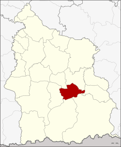 Amphoe location in Sisaket Province | |
| Coordinates: 14°47′36″N 104°28′11″E / 14.79333°N 104.46972°ECoordinates: 14°47′36″N 104°28′11″E / 14.79333°N 104.46972°E | |
| Country | Thailand |
| Province | Sisaket |
| Seat | Si Kaeo |
| Area | |
| • Total | 236.684 km2 (91.384 sq mi) |
| Population (2008) | |
| • Total | 51,933 |
| • Density | 219.4/km2 (568/sq mi) |
| Time zone | UTC+7 (ICT) |
| Postal code | 33240 |
| Geocode | 3314 |
Si Rattana (Thai: ศรีรัตนะ, pronounced [sǐ rát.tā.náʔ]) is a district (amphoe) in the central part of Sisaket Province, northeastern Thailand.
Geography
Neighboring districts are (from the north clockwise) Phayu, Nam Kliang, Benchalak, Kantharalak, Khun Han and Phrai Bueng.
History
The minor district (king amphoe) was created on March 5, 1981, when the four tambon Si Kaeo, Phing Phuai, Sa Yao, and Tum were split off from Kantharalak District.[1] It was upgraded to a full district on 26 May 1989.[2]
Administration
The district is divided into seven sub-districts (tambon), which are further subdivided into 90 villages (muban). Si Rattana is a sub-district municipality (thesaban tambon), which covers parts of tambon Si Kaeo and Saphung. There are a further seven tambon administrative organizations (TAO).
| No. | Name | Thai | Villages | Pop. |
|---|---|---|---|---|
| 1. | Si Kaeo | ศรีแก้ว | 15 | 9,352 |
| 2. | Phing Phuai | พิงพวย | 14 | 8,934 |
| 3. | Sa Yao | สระเยาว์ | 14 | 7,325 |
| 4. | Tum | ตูม | 12 | 8,769 |
| 5. | Sueang Khao | เสื่องข้าว | 11 | 6,274 |
| 6. | Si Non Ngam | ศรีโนนงาม | 10 | 4,598 |
| 7. | Saphung | สะพุง | 14 | 6,681 |
References
- ↑ ประกาศกระทรวงมหาดไทย เรื่อง แบ่งท้องที่อำเภอกันทรลักษ์ จังหวัดศรีสะเกษ ตั้งเป็นกิ่งอำเภอศรีรัตนะ (PDF). Royal Gazette (in Thai). 98 (42 ง): 753. March 17, 1981.
- ↑ พระราชกฤษฎีกาตั้งอำเภอแวงใหญ่ อำเภอหนองบุนนาก อำเภอโพนทราย อำเภอท่าหลวง และอำเภอศรีรัตนะ พ.ศ. ๒๕๓๒ (PDF). Royal Gazette (in Thai). 106 (83 ก special): 249–251. May 25, 1989.
External links
- amphoe.com (Thai)