Nam Kliang District
| Nam Kliang น้ำเกลี้ยง | |
|---|---|
| Amphoe | |
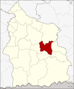 Amphoe location in Sisaket Province | |
| Coordinates: 14°55′38″N 104°30′47″E / 14.92722°N 104.51306°ECoordinates: 14°55′38″N 104°30′47″E / 14.92722°N 104.51306°E | |
| Country | Thailand |
| Province | Sisaket |
| Seat | Nam Kliang |
| Area | |
| • Total | 257.8 km2 (99.5 sq mi) |
| Population (2008) | |
| • Total | 43,339 |
| • Density | 168.1/km2 (435/sq mi) |
| Time zone | UTC+7 (ICT) |
| Postal code | 33130 |
| Geocode | 3315 |
Nam Kliang (Thai: น้ำเกลี้ยง, pronounced [náːm klîa̯ŋ]) is a district (amphoe) in the central part of Sisaket Province, northeastern Thailand.
Geography
Neighboring districts are (from the north clockwise) Kanthararom, Non Khun, Benchalak, Si Rattana, Phayu, and Mueang Sisaket.
History
The minor district (king amphoe) was created on 7 January 1986, when the four tambons, Nam Kliang, La-o, Tong Pit, and Khoen were split off from Kanthararom District.[1] It was upgraded to a full district on 4 July 1994.[2]
Administration
The district is divided into six sub-districts (tambon), which are further subdivided into 75 villages (muban). There are no municipal (thesaban) areas. There are six tambon administrative organizations (TAO).
| No. | Name | Thai | Villages | Pop. |
|---|---|---|---|---|
| 1. | Nam Kliang | น้ำเกลี้ยง | 10 | 5,869 |
| 2. | La-o | ละเอาะ | 13 | 7,703 |
| 3. | Tong Pit | ตองปิด | 14 | 7,254 |
| 4. | Khoen | เขิน | 13 | 7,904 |
| 5. | Rung Rawi | รุ่งระวี | 15 | 7,895 |
| 6. | Khup | คูบ | 10 | 6,714 |
References
- ↑ ประกาศกระทรวงมหาดไทย เรื่อง แบ่งเขตท้องที่อำเภอกันทรารมย์ จังหวัดศรีสะเกษ ตั้งเป็นกิ่งอำเภอน้ำเกลี้ยง (PDF). Royal Gazette (in Thai). 103 (9 ง): 157. January 21, 1986.
- ↑ พระราชกฤษฎีกาตั้งอำเภอเปือยน้อย ... และอำเภอศรีวิไล พ.ศ. ๒๕๓๗ (PDF). Royal Gazette (in Thai). 111 (21 ก): 32–35. June 3, 1994.
External links
- amphoe.com (Thai)
This article is issued from
Wikipedia.
The text is licensed under Creative Commons - Attribution - Sharealike.
Additional terms may apply for the media files.