Phrai Bueng District
| Phrai Bueng ไพรบึง | |
|---|---|
| Amphoe | |
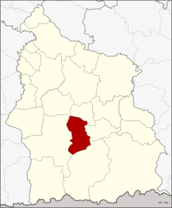 Amphoe location in Sisaket Province | |
| Coordinates: 14°44′54″N 104°21′42″E / 14.74833°N 104.36167°ECoordinates: 14°44′54″N 104°21′42″E / 14.74833°N 104.36167°E | |
| Country | Thailand |
| Province | Sisaket |
| Seat | Phrai Bueng |
| Area | |
| • Total | 248.8 km2 (96.1 sq mi) |
| Population (2009) | |
| • Total | 47,725 |
| • Density | 191.82/km2 (496.8/sq mi) |
| Time zone | UTC+7 (ICT) |
| Postal code | 33180 |
| Geocode | 3306 |
Phrai Bueng (Thai: ไพรบึง, pronounced [pʰrāj bɯ̄ŋ]) is a district (amphoe) in the central part of Sisaket Province, northeastern Thailand.
Geography
Neighboring districts are (from the north clockwise) Phayu, Si Rattana, Khun Han, Khukhan and Wang Hin.
History
The area of the district was originally part of Khukhan District. On 1 October 1969 tambons Phrai Bueng, Samrong Phlan, Din Daeng, and Prasat Yoe were split off and formed the new minor district (king amphoe) Phrai Bueng.[1] On 22 August 1975 it was upgraded to a full district.[2]
Administration
The district is divided into six sub-districts (tambon), which are further subdivided into 81 villages (muban). Phrai Bueng is a township (thesaban tambon) which covers parts of tambon Phrai Bueng and Samrong Phlan. There are a further six tambon administrative organizations (TAO).
| No. | Name | Thai name | Villages | Pop. | |
|---|---|---|---|---|---|
| 1. | Phrai Bueng | ไพรบึง | 21 | 16,121 | |
| 2. | Din Daeng | ดินแดง | 9 | 5,108 | |
| 3. | Prasat Yoe | ปราสาทเยอ | 11 | 4,872 | |
| 4. | Samrong Phlan | สำโรงพลัน | 17 | 11,448 | |
| 5. | Suk Sawat | สุขสวัสดิ์ | 12 | 5,634 | |
| 6. | Non Pun | โนนปูน | 11 | 4,393 |
References
- ↑ ประกาศกระทรวงมหาดไทย เรื่อง แบ่งท้องที่ตั้งเป็นกิ่งอำเภอ (PDF). Royal Gazette (in Thai). 86 (87 ง): 3021. October 7, 1969.
- ↑ พระราชกฤษฎีกาตั้งอำเภอแวงน้อย อำเภอป่าแดด อำเภอเรณูนคร อำเภอคูเมือง อำเภอคุระบุรี อำเภอแม่ลาน้อย อำเภอเสริมงาม อำเภอไพรบึง และอำเภอหนองโดน พ.ศ. ๒๕๑๘ (PDF). Royal Gazette (in Thai). 92 (166 ก special issue): 1–4. August 21, 1975.
External links