Sila Lat District
| Sila Lat ศิลาลาด | |
|---|---|
| Amphoe | |
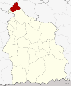 Amphoe location in Sisaket Province | |
| Coordinates: 15°28′24″N 104°4′18″E / 15.47333°N 104.07167°ECoordinates: 15°28′24″N 104°4′18″E / 15.47333°N 104.07167°E | |
| Country | Thailand |
| Province | Sisaket |
| Seat | Kung |
| Area | |
| • Total | 131.8 km2 (50.9 sq mi) |
| Population (2005) | |
| • Total | 20,857 |
| • Density | 158.2/km2 (410/sq mi) |
| Time zone | UTC+7 (ICT) |
| Postal code | 33160 |
| Geocode | 3322 |
Sila Lat (Thai: ศิลาลาด) is a district (amphoe) in the northwestern part of Sisaket Province, northeastern Thailand.
History
The minor district (king amphoe) was established on 1 July 1997, when four tambons were split off from Rasi Salai District.[1]
On 15 May 2007, all 81 minor districts were upgraded to full districts.[2] On 24 August, the upgrade became official.[3]
Geography
Neighboring districts are (from the south clockwise) Rasi Salai of Sisaket Province, Phon Sai, Nong Hi, and Phanom Phrai of Roi Et Province, and Maha Chana Chai of Yasothon Province.
Administration
The district is divided into four sub-districts (tambon), which are further subdivided into 44 villages (muban). There are no municipal (thesaban) areas, and four tambon administrative organizations (TAO).
| No. | Name | Thai name | Villages | Pop. | |
|---|---|---|---|---|---|
| 1. | Kung | กุง | 14 | 8,181 | |
| 2. | Khli Kling | คลีกลิ้ง | 11 | 5,439 | |
| 3. | Nong Bua Dong | หนองบัวดง | 9 | 4,530 | |
| 4. | Chot Muang | โจดม่วง | 10 | 2,707 |
References
- ↑ ประกาศกระทรวงมหาดไทย เรื่อง แบ่งเขตท้องที่อำเภอราษีไศล จังหวัดศรีสะเกษ ตั้งเป็นกิ่งอำเภอศิลาลาด (PDF). Royal Gazette (in Thai). 114 (Special 51 ง): 18. June 25, 1997.
- ↑ แถลงผลการประชุม ครม. ประจำวันที่ 15 พ.ค. 2550 (in Thai). Manager Online.
- ↑ พระราชกฤษฎีกาตั้งอำเภอฆ้องชัย...และอำเภอเหล่าเสือโก้ก พ.ศ. ๒๕๕๐ (PDF). Royal Gazette (in Thai). 124 (46 ก): 14–21. August 24, 2007.
External links
This article is issued from
Wikipedia.
The text is licensed under Creative Commons - Attribution - Sharealike.
Additional terms may apply for the media files.