Arundel
| Arundel | |
|---|---|
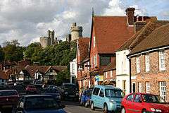 Town overlooked by castle | |
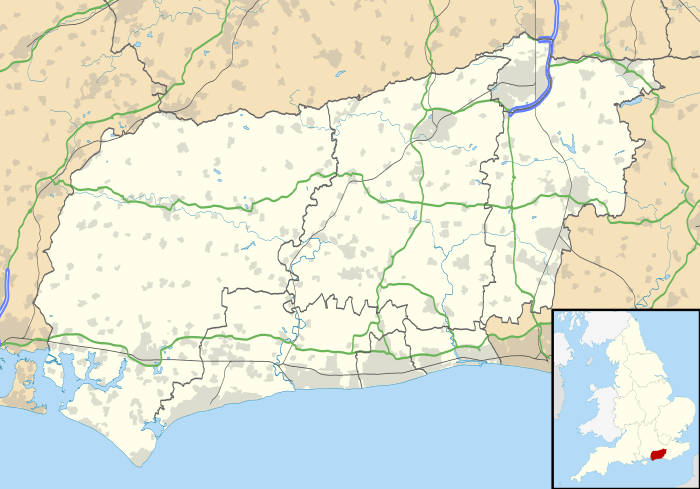 Arundel Arundel shown within West Sussex | |
| Area | 12.13 km2 (4.68 sq mi) [1] |
| Population | 3,475 (Civil Parish.2011)[2] |
| • Density | 286/km2 (740/sq mi) |
| OS grid reference | TQ018070 |
| • London | 49 miles (79 km) NNE |
| Civil parish |
|
| District | |
| Shire county | |
| Region | |
| Country | England |
| Sovereign state | United Kingdom |
| Post town | ARUNDEL |
| Postcode district | BN18 |
| Dialling code | 01903 |
| Police | Sussex |
| Fire | West Sussex |
| Ambulance | South East Coast |
| EU Parliament | South East England |
| UK Parliament | |
Arundel (/ˈærəndəl/ or locally /ˈɑːndəl/) is a market town and civil parish in a steep vale of the South Downs, West Sussex, England.
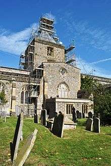
The much-conserved town has a medieval castle and Roman Catholic cathedral. Although smaller in population than most other parishes, Arundel has a museum and comes second behind much larger Chichester in its number of listed buildings in West Sussex. The River Arun runs through the eastern side of the town.
Arundel was one of the boroughs reformed by the Municipal Reform Act 1835. From 1836-1889 the town had its own Borough police force with a strength of three.[3] In 1974 it became part of the Arun district, and is now a civil parish with a town council.
Name
The name was spelled Arundell. The modern spelling dates to the 18th century.[4]
The etymology of the name is usually derived from the name of River Arun, a British hydronym, combined with Anglo-Saxon dell.[5]
A popular etymology, reflected in the municipal coat of arms, connects the Norman French word for "swallow", aronde.[6]
Governance
An electoral ward of the same name exists. This ward stretches north to Houghton with a total population at the 2011 census of 4,298.[7]
Geography
Arundel civil parish occupies an area somewhat larger than its built-up clusters, with the old town towards the north and the new to the south, separated by a main road.[8]
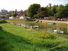
Arundel town is a major bridging point over the River Arun as it was the lowest road bridge until the opening of the Littlehampton swing bridge in 1908. Arundel Castle was built by the Normans to protect that vulnerable fairly wooded plain to the north of the valley through the South Downs. The town later grew up on the slope below the castle to the south.[9] The river was previously called the Tarrant and was renamed after the town by antiquarians in a back-formation.
Arundel includes meadows to the south but is clustered north of the A27 road, which narrowly avoids the town centre by a short and congested single carriageway bypass. Plans for a more extensive, HQDC bypass were debated intensely between 1980 and 2010 and a junction was built for it at Crossbush. In Spring 2018, Highways England published their preferred route for the new bypass. [10] During 2018-19 there is a further period of consultation when views on a more detailed design for the four-mile dual carriageway will be sought.
Arundel railway station is on the Arun Valley Line. The Monarch's Way long-distance footpath passes through the town and crosses the river here, while just under five miles north and north-west of the town the route of the South Downs Way runs.
The town itself lies outside the boundaries of the South Downs National Park.
Society
Arundel is home to Arundel Castle, seat of the Duke of Norfolk; and to Arundel Cathedral, seat of the (Catholic) Bishop of Arundel and Brighton.
On 6 July 2004, Arundel was granted Fairtrade Town status.[11]
People born in Arundel are known locally as Mullets, due to the presence of mullet in the River Arun.[12]
Arundel is home to one of the oldest Scout Groups in the world. 1st Arundel (Earl of Arundel's Own) Scout Group was formed in 1908 only a few weeks after Scouting began.[13] Based in an HQ in Green Lane Close, it has active sections of Beaver Scouts, Cub Scouts and Scouts.
Sport and leisure
Arundel has a non-League football club Arundel F.C. which plays at Mill Road.
The town also has its own cricket ground at the castle, often cited as being one of the country's most picturesque.[14] It hosts Sussex County Cricket Club for a number of games each season.
Notable people
- Christopher Alexander, architect.
- George Constable, local brewer and amateur artist, whose work is now in the Tate. [15] He was a friend of John Constable.
- Derek Davis, potter and painter
- Judy Geeson, actress.
- Cara Horgan, actress.
- Philip Howard, 20th Earl of Arundel, part of the court of Queen Elizabeth I and a martyr for the Catholic faith. He was taken to the Tower of London with his dog in 1585 and died in 1595. His bones can be found in an altar at Arundel Cathedral.
- Amelia Frances Howard-Gibbon was born in nearby Littlehampton and lived at Arundel as a child. She is buried with her father and former town mayor Edward Howard Howard-Gibbon at Saint Nicholas Churchyard in Arundel.
- C.E.M. Joad, Philosopher and broadcaster, wrote many books at South Stoke Farm near Arundel.
- George MacDonald, pastor of Trinity Congregational Church, 1850.
- Francis Meynell, publisher.
- Liam Treadwell, jockey.[16]
See also
References
- ↑ "2001 Census: West Sussex – Population by Parish" (PDF). West Sussex County Council. Archived from the original (PDF) on 8 June 2011. Retrieved 26 March 2009.
- ↑ Key Statistics; Quick Statistics: Population Density United Kingdom Census 2011 Office for National Statistics Retrieved 21 November 2013
- ↑ Neville Poulsom, Mike Rumble and Keith Smith 'Sussex Police forces;a pictorial history from 1836 to 1986' (Middleton Press) (1987) ISBN 0 906520 436
- ↑ Allison, Francis D. (1931). The Story of Arundel. Arundel Press. p. 16.
- ↑ "Armis". Romanmap.com. Archived from the original on 8 September 2013. Retrieved 4 June 2013.
- ↑ "ARUNDEL - Online Information article about ARUNDEL". Encyclopedia.jrank.org. Retrieved 4 June 2013.
- ↑ "Ward population 2011". Retrieved 13 October 2015.
- ↑ "Parish Headcounts, Area: Arundel CP". Neighbourhood Statistics. Office for National Statistics. 2001. Retrieved 5 April 2008.
- ↑ Arundel Castle, Schedule Ancient Monument and Grade I listed building Historic England. "Details from listed building database (1012500)". National Heritage List for England. Retrieved 5 May 2014.
- ↑ "A27 Arundel Bypass Preferred route announcement" (PDF). Highways England. Retrieved 16 July 2018.
- ↑ Fairtrade town status Archived 7 March 2008 at the Wayback Machine.
- ↑ "Facts about West Sussex". West Sussex County Council. 23 October 2006. Archived from the original on 8 June 2009. Retrieved 28 March 2009.
- ↑ "Forward! Once more..." (PDF). Newsletter Issue 1. Arundel Scout Group. January 2008. p. 1. Archived from the original (PDF) on 9 March 2012. Retrieved 16 March 2009.
- ↑ Cricinfoengland
- ↑ http://www.tate.org.uk/art/artworks/constable-landscape-with-cottage-and-figures-t03236
- ↑ "Grand National winner Liam Treadwell offered chance to fix teeth for free". The Telegraph. 23 April 2009. Retrieved 6 August 2018.
External links
| Wikimedia Commons has media related to Arundel. |
| Wikivoyage has a travel guide for Arundel (England). |
- Town Council
- Arundel in the Domesday Book