Shabaqua Corners
| Shabaqua Corners | |
|---|---|
|
dispersed rural community unincorporated area | |
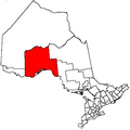
 Shabaqua Corners Location in Ontario | |
| Coordinates: 48°35′37″N 89°53′16″W / 48.59361°N 89.88778°WCoordinates: 48°35′37″N 89°53′16″W / 48.59361°N 89.88778°W[1] | |
| Country | Canada |
| Province | Ontario |
| District | Thunder Bay |
| Geographic township | Dawson Road Lots |
| Elevation[2] | 427 m (1,401 ft) |
| Time zone | UTC-5 (Eastern Time Zone) |
| • Summer (DST) | UTC-4 (Eastern Time Zone) |
| Postal Code | P0T 1X0 |
| Area code(s) | 807 |
Shabaqua Corners is a dispersed rural community and unincorporated area in geographic Dawson Road Lots Township[3] in the Unorganized Part of Thunder Bay District in Northwestern Ontario, Canada.[1] It is 56 kilometres (35 mi) west of Thunder Bay at the junction of Ontario Highway 17 and Ontario Highway 11; both highways at this point are part of the Trans-Canada Highway. There is an Ontario Provincial Police detachment in the community. The Oskondaga River flows through the community to its mouth at the Shebandowan River just to the south.
References
- 1 2 "Shabaqua Corners". Geographical Names Data Base. Natural Resources Canada. Retrieved 2014-09-02.
- ↑ Taken from Google Earth at geographic coordinates, accessed 2014-09-02.
- ↑ "Dawson Road" (PDF). Geology Ontario - Historic Claim Maps. Ontario Ministry of Northern Development, Mines and Forestry. Archived from the original (PDF) on 2014-09-03. Retrieved 2014-09-02.
Other map sources:
- Map 13 (PDF) (Map). 1 : 1,600,000. Official road map of Ontario. Ministry of Transportation of Ontario. 2014. Retrieved 2014-09-02.
- Restructured municipalities - Ontario map #2 (Map). Restructuring Maps of Ontario. Ontario Ministry of Municipal Affairs and Housing. 2006. Retrieved 2014-09-02.
This article is issued from
Wikipedia.
The text is licensed under Creative Commons - Attribution - Sharealike.
Additional terms may apply for the media files.