East Gorham
| East Gorham | |
|---|---|
| Local services board | |
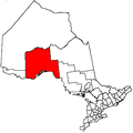
 East Gorham Location of the board office in Ontario | |
| Coordinates: 48°33′48″N 89°25′02″W / 48.56333°N 89.41722°WCoordinates: 48°33′48″N 89°25′02″W / 48.56333°N 89.41722°W[1] | |
| Country | Canada |
| Province | Ontario |
| District | Thunder Bay |
| Government | |
| • Chair | Shelley Tuomi |
| • Board Members | John Guarasci, Jim Parkes, Dennis Thibodeau, Pat Williams |
| Elevation[2] | 451 m (1,480 ft) |
| Time zone | UTC-5 (Eastern Time Zone) |
| • Summer (DST) | UTC-4 (Eastern Time Zone) |
| Postal code | P7G |
| Area code(s) | 807 |
East Gorham is a local services board for the unincorporated geographic townships of Gorham[3][4] and Jacques[5][6] in Thunder Bay District, Ontario, Canada.[7]
The area is counted as part of Unorganized Thunder Bay District in Statistics Canada census data.
The elections for the board for the period October 1, 2014 to September 30, 2015, held on September 13, 2014, had the result of Shelley Tuomi as chair and John Guarasci, Jim Parkes, Dennis Thibodeau, Pat Williams as board members.[8]
The community of Lappe is at the southern border of the board's jurisdiction at the junction of Ontario Highway 589 and Ontario Highway 591. Ontario Highway 589 continues north through Gorham and Jacques townships and then further on its way to its northern terminus at Dog Lake.
References
- ↑ Coordinates taken from Google Earth at mailing address of the board: 5 Kam Current Road; Gorham, ON; P7G 0J7. Accessed 2015-07-06.
- ↑ Elevation taken from Google Earth at coordinates given in the Infobox. Accessed 2015-07-06.
- ↑ "Gorham". Geographical Names Data Base. Natural Resources Canada. Retrieved 2015-07-06.
- ↑ "Gorham" (PDF). Geology Ontario - Historic Claim Maps. Ontario Ministry of Northern Development, Mines and Forestry. Archived from the original (PDF) on 2015-07-07. Retrieved 2015-07-06.
- ↑ "Jacques". Geographical Names Data Base. Natural Resources Canada. Retrieved 2015-07-06.
- ↑ "Jacques" (PDF). Geology Ontario - Historic Claim Maps. Ontario Ministry of Northern Development, Mines and Forestry. Archived from the original (PDF) on 2015-07-07. Retrieved 2015-07-06.
- ↑ Local Services Boards, R.R.O. 1990, Reg. 737 Archived March 10, 2014, at the Wayback Machine.. Canadian Legal Information Institute.
- ↑ "Autumn 2014 Newsletter". Local Services Board of East Gorham. Retrieved 2015-07-06.
Other map sources:
- Map 13 (PDF) (Map). 1 : 1,600,000. Official road map of Ontario. Ministry of Transportation of Ontario. 2014. Retrieved 2015-07-06.
- Restructured municipalities - Ontario map #2 (Map). Restructuring Maps of Ontario. Ontario Ministry of Municipal Affairs and Housing. 2006. Retrieved 2015-07-06.