Burchell Lake
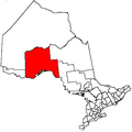
Burchell Lake is a ghost town in the Canadian province of Ontario, located behind a locked gate at the southern end of Highway 802 in the Thunder Bay District.
A copper mining town (sometimes associated with Kashabowie) was a mining town with intermittant operation of the 'Tip Top' mine. The mine operated in various periods from the 1890's through the 1930's. The site was explored by a new company 'North Coldstream Mines' and was placed into production in 1957. Operations ceased in 1967 and the property was abandoned. At its peak, the town had approximately 400 residents.[1] The Burchell Lake area had seen mineral exploration as early as 1902, but active development of mining operations in the area was not economically feasible until the completion of Highway 11 through the region in 1954.[1] After a mine shaft and mill complex was built, the Coldstream Copper Mines company began building a townsite for its workers in 1959.[1]
However, the price of copper had fallen sufficiently by 1967 that the mine was no longer profitable, and the site was shut down in 1967. In less than ten years of operations, workers at Burchell Lake had mined an estimated 102 million pounds of ore.[1]
A number of recreational cottages are still located in the area.
Easily accessible, Burchell Lake remained one of Ontario's best-preserved ghost towns for many years, with many of its buildings still standing at the townsite as of summer 2011. These include a dozen or so houses (some with basements), the original BA gas station, two room school, and collapsed recreation hall. The baseball cage can also be found with the original scoreboard. Street lamps, a sewer cover, and a fire hydrant also exist. According to a sign at the main gate, it appears as though the preparation for future demolition will take place soon, perhaps spring/summer 2012. The mine site was subsequently re-mediated by Denison Environmental with all surface structures demolished, mine openings properly sealed and mine wastes stabilized and covered with bio-solids to encourage vegetation growth.
A 40-year community reunion was held in nearby Shebandowan in 2007.[2]
References
- 1 2 3 4 Burchell Lake at Ontario Abandoned Places.
- ↑ Burchell Lake Reunion Archived September 8, 2008, at the Wayback Machine.