Township (Canada)
The term township generally means the district or area associated with a town. However, in some systems, no town needs to be involved. The specific use of the term to describe political subdivisions has varied by country, usually to describe a local rural or semi-rural government within the country itself.
In eastern Canada a township is one form of the subdivision of a county. In Canadian French, it is called a canton.
Atlantic Canada
The a historic colony of Nova Scotia (present-day Nova Scotia, New Brunswick, and Prince Edward Island) used the term township as a subdivision of counties. In Prince Edward Island's case, the colonial survey of 1764 established 67 townships, known as lots, and 3 royalties, which were grouped into parishes, and hence into counties; the townships were geographically and politically the same. In New Brunswick, parishes have taken over as the present-day subdivision of counties, whereas present-day Nova Scotia uses districts where appropriate.
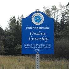
Ontario
In Ontario, there are both geographic townships and township municipalities. Geographic townships are the original historical administrative subdivisions surveyed and established primarily in the 1800s. These are used primarily for geographic purposes, such as land surveying, natural resource exploration and tracking of phenomena such as forest fires or tornados. Township municipalities, also called "political townships", are areas that have been incorporated and are a lower-tier municipality (if located in a county or regional municipality, IE in Southern Ontario) or single-tier municipality (if located in a district IE Northern Ontario).[1]
A township municipality may consist of a portion of one or more geographic townships united as a single entity with a single municipal administration. They usually consist of one or more communities that are not incorporated for various reasons. Often rural counties are subdivided into townships. In some places, usually if the township is in a county rather than in a regional municipality, the head of a political township is called a reeve, not a mayor. However, this distinction is changing as many rural townships are replacing the title Reeve with the mayor to reduce confusion. A few townships keep both titles and designate mayor as the head of the municipal council and use the title Reeve to denote the representative to the upper tier (usually county) council.
The term "geographic township" is also used in reference to former political townships which were abolished or superseded as part of municipal government restructuring.
Quebec
In Quebec, townships are called cantons in French and can also be political and geographic, similar to Ontario, although the geographic use is now very limited or not used at all. They were introduced after the British conquest primarily as a surveying unit. They were designated and cover most of the unattributed territory in Eastern Quebec and what is now known as the Eastern Townships, and later used in surveying the Outaouais and Saguenay-Lac-Saint-Jean regions. Townships often served as the territorial basis for new municipalities, but township municipalities are no different from other types such as parish or village municipalities.
Western Canada
In the Prairie provinces and parts of British Columbia, a township is a division of the Dominion Land Survey. Townships are (mostly) 6-by-6-mile (9.7 by 9.7 km) squares – about 36 square miles (93 km2) in area. These townships are not political units (although political boundaries often follow township boundaries), but exist only to define parcels of land in a relatively simple way. Townships are divided into 36 equal 1-by-1-mile (1.6 by 1.6 km) square parcels known as sections. In Saskatchewan, a political unit called a rural municipality in general is 3 townships by 3 townships in size, or 18 miles squared – about 324 square miles (840 km2).
Three municipalities in British Columbia, Langley, Esquimalt and Spallumcheen, have "township" in their official names, but legally hold the status of district municipalities.
See also
References
- ↑ "Frequently Asked Questions Geographic Township and Lot Fabric Improved Data Layers" (PDF). the Government of Ontario. 2015. Retrieved 20 June 2017.