Santo Domingo Oeste
| Santo Domingo Oeste | ||
|---|---|---|
| ||
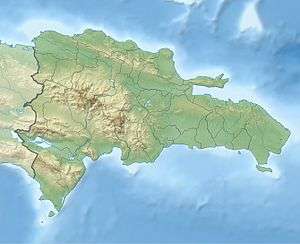
 Santo Domingo Oeste Santo Domingo Oeste in the Dominican Republic | ||
| Coordinates: 18°30′0″N 70°0′0″W / 18.50000°N 70.00000°WCoordinates: 18°30′0″N 70°0′0″W / 18.50000°N 70.00000°W | ||
| Country |
| |
| Province | Santo Domingo | |
| Municipality since | 2001 | |
| Area[1] | ||
| • Total | 54.10 km2 (20.89 sq mi) | |
| Population (2012)[2] | ||
| • Total | 693,255 | |
| • Density | 13,000/km2 (33,000/sq mi) | |
| Municipal Districts |
0 | |
| Website | http://www.asdo.gov.do/web/ | |
Santo Domingo Oeste is a municipality of the Santo Domingo province in the Dominican Republic.
For comparison with other municipalities and municipal districts see the list of municipalities and municipal districts of the Dominican Republic.
Santo Domingo Oeste was created as municipality in 2001 by law 163-01 splitting the Santo Domingo province from the Distrito Nacional including parts of metropolitan Santo Domingo west of the DR-1 (Autopista Duarte).[3]
References
- ↑ Superficies a nivel de municipios, Oficina Nacional de Estadistica Archived 2009-04-17 at the Wayback Machine.
- ↑ "Informe Básico - IX Censo Nacional de Población y Vivienda" (in Spanish). Oficina Nacional de Estadistica. 2012-05-05. Archived from the original on 2012-10-31. Retrieved 2012-05-25.
- ↑ EL CONGRESO NACIONAL. "Ley No. 163-01 que crea la provincia de Santo Domingo, y modifica los Artículos 1 y 2 de la Ley No. 5220, sobre División Territorial de la República Dominicana" (in Spanish). Archived from the original on 2007-05-18. Retrieved 2007-03-08.
This article is issued from
Wikipedia.
The text is licensed under Creative Commons - Attribution - Sharealike.
Additional terms may apply for the media files.
