La Vega Province
.
| La Vega | |||
| Province | |||
|
|||
| Country | |||
|---|---|---|---|
| City | Concepción La Vega | ||
| Capital | Concepción de La Vega | ||
| - elevation | 100 m (328 ft) | ||
| - coordinates | 19°13′12″N 70°31′48″W / 19.22000°N 70.53000°WCoordinates: 19°13′12″N 70°31′48″W / 19.22000°N 70.53000°W | ||
| Area | 2,287.24 km2 (883 sq mi) | ||
| Population | 447,905 (2014) [1] | ||
| Density | 196/km2 (508/sq mi) | ||
| Province since | 1844 | ||
| Governor | Bolivar Marte | ||
| Subdivisions | 4 municipalities 7 municipal districts | ||
| Congresspersons | 1 Senator 8 Deputies | ||
| Timezone | EST (UTC-4) | ||
| Area code | 1–809 1–829 1–849 | ||
| ISO 3166-2 | DO-13 | ||
| Postal Code | 41000 | ||
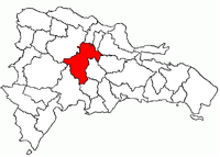 Location of the La Vega Province | |||


La Vega (Spanish pronunciation: [la ˈβeɣa]) is a province of the Dominican Republic. Until 1992 it included what is now Monseñor Nouel province.
Municipalities and municipal districts
The province as of June 20, 2006 is divided into the following municipalities (municipios) and municipal districts (distrito municipal – D.M.) within them:[2]
- Concepción de La Vega
- El Ranchito (D.M.)
- Río Verde Arriba (D.M.)
- Cutupú
- Constanza
- La Sabina (D.M.)
- Tireo (D.M.)
- Jarabacoa
- Buena Vista (D.M.)
- Manabao (D.M.)
- Jima Abajo
- Rincón (D.M.)
For comparison with the municipalities and municipal districts of other provinces see the list of municipalities and municipal districts of the Dominican Republic.
The following is a sortable table of the municipalities and municipal districts with population figures as of the 2012 census. Urban population are those living in the seats (cabeceras literally heads) of municipalities or of municipal districts. Rural population are those living in the districts (Secciones literally sections) and neighborhoods (Parajes literally places) outside of them.[3]
| Name | Total population | Urban population | Rural population |
|---|---|---|---|
| Concepción de la Vega | 235,698 | 101,585 | 134,113 |
| Constanza | 85,240 | 40,019 | 45,221 |
| Jarabacoa | 69,855 | 32,585 | 37,270 |
| Jima Abajo | 29,685 | 27,796 | 1,889 |
| La Vega province | 420,478 | 201,985 | 218,493 |
References
- ↑ Consejo Nacional de Población y Familia. "Estamaciones y Proyecciones de la Población Dominicana por Regiones, Provincias, Municipios y Distritos Municipales, 2014" (PDF) (in Spanish). Retrieved 2014-02-02.
- ↑ Oficina Nacional de Estadistica, Departamento de Cartografia, Division de Limites y Linderos. "Listado de Codigos de Provincias, Municipio y Distritos Municipales, Actualizada a Junio 20 del 2006" (in Spanish). Archived from the original on March 14, 2007. Retrieved 2007-01-24.
- ↑ Consejo Nacional de Población y Familia. "Censos y Proyecciones de la Población Dominicana por Regiones, Provincias, Municipios y Distritos Municipales, 2012" (PDF) (in Spanish). Retrieved January 11, 2012.
External links
- (in Spanish) Oficina Nacional de Estadística, Statistics Portal of the Dominican Republic
- (in Spanish) Oficina Nacional de Estadística, Maps with administrative division of the provinces of the Dominican Republic, downloadable in PDF format