Valverde Province
| Valverde | |||
| Province | |||
|
|||
| Country | |||
|---|---|---|---|
| Capital | Santa Cruz de Mao | ||
| - elevation | 78 m (256 ft) | ||
| - coordinates | 19°34′00″N 71°05′00″W / 19.56667°N 71.08333°WCoordinates: 19°34′00″N 71°05′00″W / 19.56667°N 71.08333°W | ||
| Area | 823.38 km2 (318 sq mi) | ||
| Population | 217,026 (2014) [1] | ||
| Density | 264/km2 (684/sq mi) | ||
| Province since | 1959 | ||
| Subdivisions | 3 municipalities 10 municipal districts | ||
| Congresspersons | 1 Senator 3 Deputies | ||
| Timezone | AST (UTC-4) | ||
| Area code | 1-809 1-829 1-849 | ||
| ISO 3166-2 | DO-27 | ||
| Postal Code | 61000 | ||
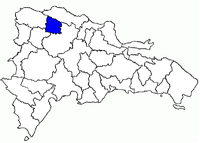 Location of the Valverde Province | |||


Valverde (Spanish pronunciation: [balˈβeɾðe]) is a province of the Dominican Republic. It was split from Santiago Province in 1959.
Municipalities and municipal districts
The province as of June 20, 2006 was divided into the following municipalities (municipios) and municipal districts (distrito municipal - D.M.) and the municipal Seat (distrito cabecera - D.C.) within them:[2]
- Santa Cruz de Mao, head municipality of the province
- Ámina (D.M.)
- Guatapanal (D.M.)
- Jaibón de Pueblo Nuevo (D.M.)
- Esperanza
- Boca de Mao (D.M.)
- Jicomé (M.D.)
- Maizal (M.D.)
- Paradero (M.D.)
- Laguna Salada
- Cruce de Guayacanes (D.M.)
- Jaibón (D.M.)
- La Caya (D.M.)
The following is a sortable table of the municipalities with population figures as of the 2012 census; the population figures for the municipal districts are included within their municipalities. Urban population are those living in the seats (cabeceras: literally, heads) of municipalities or of municipal districts. Rural population are those living in the districts (Secciones: literally, sections) and neighborhoods (Parajes: literally, places) outside of them.[3]
| Name | Total population | Urban population | Rural population |
|---|---|---|---|
| Esperanza | 70,588 | 52,732 | 17,856 |
| Laguna Salada | 30,041 | 20,470 | 9,571 |
| Santa Cruz de Mao | 106,818 | 80,925 | 25,893 |
| Valverde Province | 207,447 | 154,127 | 53,320 |
For comparison with the municipalities and municipal districts of other provinces see the list of municipalities and municipal districts of the Dominican Republic.
References
- ↑ Consejo Nacional de Población y Familia. "Estamaciones y Proyecciones de la Población Dominicana por Regiones, Provincias, Municipios y Distritos Municipales, 2014" (PDF) (in Spanish). Retrieved 2014-02-02.
- ↑ Oficina Nacional de Estadistica, Departamento de Cartografia, Division de Limites y Linderos. "Listado de Codigos de Provincias, Municipio y Distritos Municipales, Actualizada a Junio 20 del 2006" (in Spanish). Archived from the original on 2007-03-14. Retrieved 2007-01-24.
- ↑ Consejo Nacional de Población y Familia. "Censos y Proyecciones de la Población Dominicana por Regiones, Provincias, Municipios y Distritos Municipales, 2012" (PDF) (in Spanish). Retrieved 2012-01-11.
External links
- (in Spanish) Oficina Nacional de Estadística, Statistics Portal of the Dominican Republic
- (in Spanish) Oficina Nacional de Estadística, Maps with administrative division of the provinces of the Dominican Republic, downloadable in PDF format