Shangjie District
| Shangjie 上街区 | |
|---|---|
| District | |
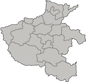
 Location in Zhengzhou | |
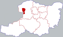
 Shangjie Location in Henan | |
| Coordinates: 34°48′10″N 113°18′32″E / 34.80278°N 113.30889°ECoordinates: 34°48′10″N 113°18′32″E / 34.80278°N 113.30889°E | |
| Country | People's Republic of China |
| Province | Henan |
| Prefecture-level city | Zhengzhou |
| Township-level divisions |
5 subdistricts 1 town |
| District seat | Jiyuan Road Subdistrict (济源路街道) |
| Area | |
| • Total | 64.7 km2 (25.0 sq mi) |
| Elevation | 159 m (522 ft) |
| Population | |
| • Total | 131,540 |
| • Density | 2,000/km2 (5,300/sq mi) |
| Time zone | UTC+8 (China Standard) |
| Website |
www |
Shangjie (Chinese: 上街; pinyin: Shàngjiē; literally: "upper street") is a western district of the city of Zhengzhou, Henan Province, People's Republic of China, located about 38 kilometres (24 mi) west of the city proper in between the Yellow River to the north and Mount Song to the south; it is not contiguous with the other five districts of Zhengzhou. Shangjie District was established as an industrial zone in 1958. It has an area of 64.7 square kilometres (25.0 sq mi) and a population of about 130,000.[1]
Administrative divisions
There are five subdistricts and one town under the district's administration:[2]
- Jiyuan Road Subdistrict (济源路街道)
- Zhongxin Road Subdistrict (中心路街道)
- Xin'an Road Subdistrict (新安路街道)
- Gongye Road Subdistrict (工业路街道)
- Kuangshan Subdistrict (矿山街道)
- Xiawo (峡窝镇)
References
- ↑ (in Chinese) Profile of Shangjie District, Official website of Shangjie District Government. Archived March 8, 2008, at the Wayback Machine.
- ↑ 2011年统计用区划代码和城乡划分代码:上街区 (in Chinese). National Bureau of Statistics of the People's Republic of China. Retrieved 2012-12-29.
External links
This article is issued from
Wikipedia.
The text is licensed under Creative Commons - Attribution - Sharealike.
Additional terms may apply for the media files.