Huangchuan County
| Huangchuan County 潢川县 | |
|---|---|
| County | |
 Aerial view of Huangchuan | |
 Huangchuan Location in Henan | |
| Coordinates: 32°08′13″N 115°02′52″E / 32.13694°N 115.04778°ECoordinates: 32°08′13″N 115°02′52″E / 32.13694°N 115.04778°E | |
| Country | People's Republic of China |
| Province | Henan |
| Prefecture-level city | Xinyang |
| Settled | c. 21st century BC |
| - Yiyang County | 206 BC |
| - Guangzhou | 712 AD |
| - Huangchuan | 1913 AD |
| Government | |
| • Secretary | vacancy (CPC) |
| • Magistrate | Zhao Liang |
| Area[1] | |
| • County | 1,661.1 km2 (641.4 sq mi) |
| • Water | 107 km2 (41 sq mi) |
| • Metro | 33.4 km2 (12.9 sq mi) |
| Dimensions | |
| • Length | 53 km (33 mi) |
| • Width | 44.5 km (27.7 mi) |
| Elevation | 45 m (148 ft) |
| Highest elevation[2] | 330 m (1,080 ft) |
| Lowest elevation[2] | 30 m (100 ft) |
| Population (2009) | |
| • County | 838,000 |
| • Density | 500/km2 (1,300/sq mi) |
| • Metro | 280,000 |
| • Metro density | 8,400/km2 (22,000/sq mi) |
| Time zone | UTC+8 (China Standard) |
| Postal code | 465150 |
| Area code(s) | 376 |
| ISO 3166 code | CN-41-11-25 |
| Licence plate prefix | 豫S3 |
| Website |
www |
Huangchuan County (simplified Chinese: 潢川县; traditional Chinese: 潢川縣; pinyin: Huángchuān Xiàn; local pronunciation: Huāngchuǎn Xiàn) is a county of southeastern Henan province, People's Republic of China. It is located in the center of Xinyang City, straddling the Huang River. That is why it is named Huangchuan, meaning where Huang River flows.
History
Origin and early development
According to the ancient Chinese text Bamboo Annals, Huangchuan was the national capital of the first Kingdom of Huang in the Xia dynasty during the 21st century BCE. Later, in the beginning of the Zhou dynasty, a second and separate Kingdom of Huang was founded by King Huang Huilian, and he re-established his national capital in Huangchuan like his early predecessor in the Xia dynasty. His name Huang is considered to be the root origin of the royal ancient Chinese surname Huang (or Hwang).[3] The Kingdom of Huang was later invaded and annexed by the Kingdom of Chu and became a vassal state under the Zhou dynasty in 648 BCE, during the Spring and Autumn period.
Remains of the capital of the Kingdom of Huang were discovered in Longgu, a township six kilometers northwest to the urban area of Huangchuan.[4]
Empire period
After the Qin dynasty. Huangchuan was generally established as a zhou, a commandery or a county.
According to Brief Sketch of North Parts of Ming Dynasty (Chinese: 明季北略), a book by Ji Liuqi (计六奇) recording the transitional period from the Ming dynasty to the Qing dynasty, Huangchuan (then Guangzhou) was devastated and the residents massacred by the peasant army. And now residents in Huangchuan are mainly descendants of migrants from Jiangxi, Fujian and Guangdong settled down during the Kangxi era in the Qing dynasty.
Republic period
In 1913, Huangchuan was renamed to its current name.[5]
In 2009, Huang-Guang Integration project was launched aiming to integrate Huangchuan County and neighboring Guangshan County.
Former names
- traditional Chinese: 黃國; simplified Chinese: 黄国; pinyin: Huángguó
- traditional Chinese: 弋陽; simplified Chinese: 弋阳; pinyin: Yìyáng
- Chinese: 定城; pinyin: Dìngchéng
- Chinese: 光州; pinyin: Guāngzhōu
Geography
Huangchuan borders the Huai River in the north, which is regarded as part of the geographical dividing line between North China and South China.
Huang River, a tributary of Huai River, is pronounced the same as Yellow River yet with different characters. Local residents usually call it Little Huang River (pinyin: Xiǎo Huáng Hé).
The annual mean temperature is 15.3 °C (59.5 °F) and precipitation averages 1,039 millimetres (40.9 in).
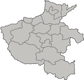
Administrative divisions
Huangchuan County currently has 4 subdistricts, 9 towns and 8 townships.[6] The county was reorganized in 2005, when the townships of Xiaoludian (小吕店乡) and Pengjiadian (彭家店乡), and the town of Niugang (牛岗镇) were assimilated into neighboring towns and townships.
Subdistricts (街道)
- Chunshen Subdistrict (春申街道)
- Dingcheng Subdistrict (定城街道)
- Yiyang Subdistrict (弋阳街道)
- Laocheng Subdistrict (老城街道)
Towns (镇)
- Shuangliushu (双柳树镇)
- Sanpisi (伞陂寺镇)
- Butaji (卜塔集镇)
- Renhe (仁和镇)
- Fudian (傅店镇)
- Xuezi (踅孜镇)
- Taolinpu (桃林铺镇)
- Huangsigang (黄寺岗镇)
- Jiangjiaji (江家集镇)
Townships (乡)
- Chuanliudian Township (传流店乡)
- Weigang Township (魏岗乡)
- Zhangji Township (张集乡)
- Lailong Township (来龙乡)
- Longgu Township (隆古乡)
- Tandian Township (谈店乡)
- Shangyougang Township (上油岗乡)
- Baidian Township (白店乡)
Transport
References
- ↑ 潢川简介 [Introduction of Huangchuan] (in Chinese). 天气网.
- 1 2 河南林业厅 (29 Oct 2008). "信阳基本地理信息分析" [Basics of Geography of Xinyang] (in Chinese). 河南户外联盟. Archived from the original on 2009-10-06. Retrieved 25 Jul 2012.
- ↑
邹克祥 (2001). "天下黄姓出江夏" [Those Surnamed Huang All From Jiangxia]. 武汉文史资料 (in Chinese) (06).
黄,即古黄国,黄国后被楚所灭,黄国人变成了黄氏楚国人。
- ↑ 金荣权 (2009). 古黄国历史变迁与文化特征综论 [the Historical Transition and Cultural Characteristics of Old Huang State]. Academic Journal of Zhongzhou (in Chinese) (01).
- ↑ 华林甫 (Dec 2003). 当代中国县城通名改革研究 [Research of The County Name Reforming of Modern China]. Collections of Essays on Chinese Historical Geography (in Chinese). 18 (04): 68.
唐太极元年(712年)迁光州州治于今潢川县城,此后一直为州治(清雍正初至宣统年间光州为直隶州)。1913年改光州为潢川县。今潢川县城作为光州州治长达一千多年。
- ↑ 2011年统计用区划代码和城乡划分代码:潢川县 (in Chinese). National Bureau of Statistics of the People's Republic of China. Retrieved 2013-01-01.
Places adjacent to Huangchuan County | ||||||||||
|---|---|---|---|---|---|---|---|---|---|---|
| ||||||||||
Administrative Divisions of Huangchuan County | ||
|---|---|---|
| Subdistricts |
|  |
| Towns |
| |
| Townships |
| |