Saint James Parish, New Brunswick
| Saint James St. James | |
|---|---|
| Parish | |
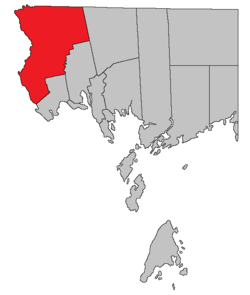 Location within Charlotte County. | |
| Country |
|
| Province |
|
| County | Charlotte County |
| Established | 1823 |
| Area[1] | |
| • Land | 556.00 km2 (214.67 sq mi) |
| Population (2011)[1] | |
| • Total | 1,241 |
| • Density | 2.2/km2 (6/sq mi) |
| • Pop 2006-2011 |
|
| • Dwellings | 590 |
| Time zone | UTC-4 (AST) |
| • Summer (DST) | UTC-3 (ADT) |
Saint James is a Canadian parish in Charlotte County, New Brunswick.[2]
History
Saint James Parish was set up in 1823 from part of Saint Stephen Parish. Saint James Parish was named after Saint James.
Delineation
Saint James Parish is defined in the Territorial Division Act[3] as being bounded:
- South by Saint Stephen Parish and Saint David Parish; east by the northerly prolongation of the east line of Saint David Parish; north by the County line; and west by the St. Croix River.
Communities
Parish population total does not include incorporated municipalities (in bold).
|
|
|
Bodies of water & Islands
This is a list of rivers, lakes, streams, creeks, marshes and Islands that are at least partially in this parish
- Potters Lake
- King Brook Lake
- Moores Mills Lake
- Cranberry Lake
- Indian Pond
- Canoose Flowage
Demographics
Population
| Canada census – Saint James Parish, New Brunswick community profile | |||
|---|---|---|---|
| 2011 | 2006 | ||
| Population: | 1,241 (-8.1% from 2006) | 1,350 (-5.6% from 2001) | |
| Land area: | 556.00 km2 (214.67 sq mi) | 555.99 km2 (214.67 sq mi) | |
| Population density: | 2.2/km2 (5.7/sq mi) | 2.4/km2 (6.2/sq mi) | |
| Median age: | 44.5 (M: 42.2, F: 46.5) | 41.7 (M: 41.2, F: 42.1) | |
| Total private dwellings: | 590 | 612 | |
| Median household income: | $51,753 | $36,461 | |
| References: 2011[1] 2006[4] earlier[5] | |||
| Historical Census Data - Saint James Parish, New Brunswick[6] | ||||||||||||||||||||||||||
|---|---|---|---|---|---|---|---|---|---|---|---|---|---|---|---|---|---|---|---|---|---|---|---|---|---|---|
|
|
| ||||||||||||||||||||||||
Language
| Canada Census Mother Tongue - Saint James Parish, New Brunswick[6] | ||||||||||||||||||
|---|---|---|---|---|---|---|---|---|---|---|---|---|---|---|---|---|---|---|
| Census | Total | French |
English |
French & English |
Other | |||||||||||||
| Year | Responses | Count | Trend | Pop % | Count | Trend | Pop % | Count | Trend | Pop % | Count | Trend | Pop % | |||||
2011 |
1,235 |
1,200 | 97.17% | 25 | 2.02% | 0 | 0.00% | 10 | 0.81% | |||||||||
2006 |
1,340 |
1,325 | 98.88% | 15 | 1.12% | 0 | 0.00% | 0 | 0.00% | |||||||||
2001 |
1,395 |
1,380 | 98.92% | 15 | 1.08% | 0 | 0.00% | 0 | 0.00% | |||||||||
1996 |
1,390 |
1,380 | n/a | 99.28% | 10 | n/a | 0.72% | 0 | n/a | 0.00% | 0 | n/a | 0.00% | |||||
Access Routes
Highways and numbered routes that run through the parish, including external routes that start or finish at the parish limits:[7]
See also
References
- 1 2 3 "2011 Community Profiles". Canada 2011 Census. Statistics Canada. July 5, 2013. Retrieved 2014-03-17.
- ↑ - Saint James Parish
- ↑ "Territorial Division Act (R.S.N.B. 1973, c. T-3)". Government of New Brunswick website. Retrieved 26 August 2016.
- ↑ "2006 Community Profiles". Canada 2006 Census. Statistics Canada. March 30, 2011. Retrieved 2014-03-17.
- ↑ "2001 Community Profiles". Canada 2001 Census. Statistics Canada. February 17, 2012.
- 1 2 Statistics Canada: 1996, 2001, 2006, 2011 census
- ↑ Atlantic Canada Back Road Atlas ISBN 978-1-55368-618-7 Pages 4, 12
External links
Places adjacent to Saint James Parish, New Brunswick | |
|---|---|
| Subdivisions | |
|---|---|
| Cities | |
| Counties | |
| |
Coordinates: 45°22′54″N 67°20′44″W / 45.381572°N 67.345505°W
This article is issued from
Wikipedia.
The text is licensed under Creative Commons - Attribution - Sharealike.
Additional terms may apply for the media files.