Saint Stephen Parish, New Brunswick
| Saint Stephen St. Stephen | |
|---|---|
| Parish | |
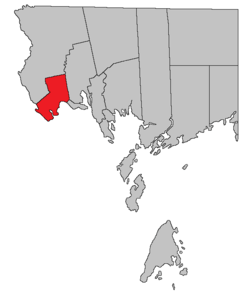 Location within Charlotte County. | |
| Country |
|
| Province |
|
| County | Charlotte County |
| Established | 1786 |
| Area[1] | |
| • Land | 103.38 km2 (39.92 sq mi) |
| Population (2011)[1] | |
| • Total | 1,986 |
| • Density | 19.2/km2 (50/sq mi) |
| • Pop 2006-2011 |
|
| • Dwellings | 827 |
| Time zone | UTC-4 (AST) |
| • Summer (DST) | UTC-3 (ADT) |
Saint Stephen is a Canadian parish in Charlotte County, New Brunswick.[2]
History
Saint Stephen Parish was established in 1786: included Saint James Parish until 1823 and Dufferin Parish until 1873..
Delineation
Saint Stephen Parish is defined in the Territorial Division Act[3] as being bounded:
- South by Dufferin Parish and the St. Croix River; east by Saint David Parish, north and west by a line beginning in the intersection of the St. Croix River with the southwesterly prolongation of the northwestern limit of Lot No. 16, granted to Angus Rankin; thence northeasterly along said prolongation and said limit to the western limit of Lot No. 115, granted to Thomas Dodd; thence northerly along the western limits of Lots Numbered 115, 116, 117 and 99 to 114 inclusive to the southern limit of Lot No. 46 granted to Thomas Grimmer Junior; thence westerly along said limit and its prolongation to the eastern limit of Lot No. 60, granted to Robert M. Todd; thence northerly along the eastern limit of Lot No. 60 and its northerly prolongation, to meet the westerly prolongation of the northern limit of No. 53 granted to Peter Christie; thence easterly along said westerly prolongation, the northern limit of Lot No. 53 and the easterly prolongation of the northern limit of Lot No. 53, to the eastern bank or shore of Moore Lake.[lower-alpha 1]
Communities
Parish population total does not include incorporated municipalities (in bold).
|
|
|
Bodies of water & Islands
This is a list of rivers, lakes, streams, creeks, marshes and Islands that are at least partially in this parish
- Kendricks Lake
- St Croix River
Demographics
Population
| Canada census – Saint Stephen Parish, New Brunswick community profile | |||
|---|---|---|---|
| 2011 | 2006 | ||
| Population: | 1,986 (-6.0% from 2006) | 2,113 (+13.8% from 2001) | |
| Land area: | 103.38 km2 (39.92 sq mi) | 104.41 km2 (40.31 sq mi) | |
| Population density: | 19.2/km2 (50/sq mi) | 20.2/km2 (52/sq mi) | |
| Median age: | 44.0 (M: 43.5, F: 44.5) | 39.6 (M: 38.9, F: 40.0) | |
| Total private dwellings: | 827 | 863 | |
| Median household income: | $50,064 | $37,430 | |
| References: 2011[1] 2006[5] earlier[6] | |||
| Historical Census Data - Saint Stephen Parish, New Brunswick[7] | ||||||||||||||||||||||||||
|---|---|---|---|---|---|---|---|---|---|---|---|---|---|---|---|---|---|---|---|---|---|---|---|---|---|---|
|
|
| ||||||||||||||||||||||||
Language
| Canada Census Mother Tongue - Saint Stephen Parish, New Brunswick[7] | ||||||||||||||||||
|---|---|---|---|---|---|---|---|---|---|---|---|---|---|---|---|---|---|---|
| Census | Total | English |
French |
English & French |
Other | |||||||||||||
| Year | Responses | Count | Trend | Pop % | Count | Trend | Pop % | Count | Trend | Pop % | Count | Trend | Pop % | |||||
2011 |
1,955 |
1,900 | 97.19% | 35 | 1.79% | 5 | 0.25% | 15 | 0.77% | |||||||||
2006 |
2,105 |
2,040 | 96.91% | 40 | 1.90% | 0 | 0.00% | 25 | 1.19% | |||||||||
2001 |
1,850 |
1,795 | 97.03% | 35 | 1.89% | 10 | 0.54% | 10 | 0.54% | |||||||||
1996 |
1,855 |
1,830 | n/a | 98.65% | 25 | n/a | 1.35% | 0 | n/a | 0.00% | 0 | n/a | 0.00% | |||||
Access Routes
Highways and numbered routes that run through the parish, including external routes that start or finish at the parish limits:[8]
See also
Footnotes
References
- 1 2 3 "2011 Community Profiles". Canada 2011 Census. Statistics Canada. July 5, 2013. Retrieved 2014-03-19.
- ↑ - Saint Stephen Parish
- ↑ "Territorial Division Act (R.S.N.B. 1973, c. T-3)". Government of New Brunswick website. Retrieved 25 August 2016.
- ↑ "Moore Lake". Canadian Geographical Names. Natural Resources Canada. Retrieved 25 August 2016.
- ↑ "2006 Community Profiles". Canada 2006 Census. Statistics Canada. March 30, 2011. Retrieved 2014-03-19.
- ↑ "2001 Community Profiles". Canada 2001 Census. Statistics Canada. February 17, 2012.
- 1 2 Statistics Canada: 1996, 2001, 2006, 2011 census
- ↑ Atlantic Canada Back Road Atlas ISBN 978-1-55368-618-7 Pages 4, 12
External links
Places adjacent to Saint Stephen Parish, New Brunswick | ||||||||||
|---|---|---|---|---|---|---|---|---|---|---|
| ||||||||||
| Subdivisions | |
|---|---|
| Cities | |
| Counties | |
| |
Coordinates: 45°12′41″N 67°19′33″W / 45.21125°N 67.325935°W
This article is issued from
Wikipedia.
The text is licensed under Creative Commons - Attribution - Sharealike.
Additional terms may apply for the media files.