Saint David Parish, New Brunswick
| Saint David St. David | |
|---|---|
| Parish | |
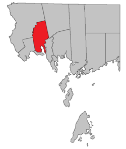 Location within Charlotte County. | |
| Country |
|
| Province |
|
| County | Charlotte County |
| Established | 1786 |
| Area[1] | |
| • Land | 189.93 km2 (73.33 sq mi) |
| Population (2011)[1] | |
| • Total | 1,605 |
| • Density | 8.5/km2 (22/sq mi) |
| • Pop 2006-2011 |
|
| • Dwellings | 787 |
| Time zone | UTC-4 (AST) |
| • Summer (DST) | UTC-3 (ADT) |
Saint David is a Canadian parish in Charlotte County, New Brunswick.[2]
History
Saint David Parish was created in 1786: named for the patron saint of Wales.
Delineation
Saint David Parish is defined in the Territorial Division Act[3] as being bounded:
- South by Dufferin Parish; west by the east line of lots on Dennis Stream prolonged southerly to Dufferin Parish and by the west lines of the grant to Henry Goldsmith and others; north by the north line of the said grant; east by the east line of the said last mentioned grant; southeast and southerly by a line commencing at the most northern angle of a four hundred and eighty-eight acre lot granted to Daniel Hill on Waweig River; thence southwesterly to the most western angle of the said lot; thence southeasterly to the northeast angle of lot number thirty, granted to W. Ross; thence westerly along the north line of the said last-mentioned grant and its western prolongation to the northeast angle of lot number eight, granted to James Garcelon; thence south to the southeast angle of lot number four, granted to James Christie; thence west to the southwest angle of the said last-mentioned lot; thence south along the eastern line of lots fronting on Oak Bay to Waweig River; thence down the channel of Waweig River and up the channel of Oak Bay to Pagans Cove, where the northern line of Dufferin Parish intersects it, excluding Rickets Island in Waweig River.
Governance
The entire parish forms the local service district of the parish of Saint David,[lower-alpha 1] established in 1969 to assess for community services. Fire protection was added in 1970 and non-fire related rescue in 2013.
Communities
Parish population total does not include incorporated municipalities (in bold).
Bodies of water & Islands
This is a list of rivers, lakes, streams, creeks, marshes and Islands that are at least partially in this parish
- Oak Bay
- Foster Lake
- Spoon Island
Demographics
Population
| Canada census – Saint David Parish, New Brunswick community profile | |||
|---|---|---|---|
| 2011 | 2006 | ||
| Population: | 1,605 (+7.1% from 2006) | 1,499 (-6.0% from 2001) | |
| Land area: | 189.93 km2 (73.33 sq mi) | 189.91 km2 (73.32 sq mi) | |
| Population density: | 8.5/km2 (22/sq mi) | 7.9/km2 (20/sq mi) | |
| Median age: | 47.8 (M: 47.9, F: 47.6) | 42.6 (M: 41.9, F: 43.1) | |
| Total private dwellings: | 787 | 676 | |
| Median household income: | $64,641 | $41,215 | |
| References: 2011[1] 2006[4] earlier[5] | |||
| Historical Census Data - Saint David Parish, New Brunswick[6] | ||||||||||||||||||||||||||
|---|---|---|---|---|---|---|---|---|---|---|---|---|---|---|---|---|---|---|---|---|---|---|---|---|---|---|
|
|
| ||||||||||||||||||||||||
Language
| Canada Census Mother Tongue - Saint David Parish, New Brunswick[6] | ||||||||||||||||||
|---|---|---|---|---|---|---|---|---|---|---|---|---|---|---|---|---|---|---|
| Census | Total | English |
French |
English & French |
Other | |||||||||||||
| Year | Responses | Count | Trend | Pop % | Count | Trend | Pop % | Count | Trend | Pop % | Count | Trend | Pop % | |||||
2011 |
1,590 |
1,530 | 96.23% | 40 | 2.52% | 5 | 0.31% | 15 | 0.94% | |||||||||
2006 |
1,495 |
1,440 | 96.32% | 25 | 1.67% | 10 | 0.67% | 20 | 1.34% | |||||||||
2001 |
1,585 |
1,555 | 98.11% | 30 | 1.89% | 0 | 0.00% | 0 | 0.00% | |||||||||
1996 |
1,630 |
1,580 | n/a | 96.93% | 40 | n/a | 2.45% | 0 | n/a | 0.00% | 10 | n/a | 0.61% | |||||
Access Routes
Highways and numbered routes that run through the parish, including external routes that start or finish at the parish limits:[7]
See also
Footnotes
- ↑ The name was styled St. David in English and St-David in French (1984) before being changed to the modern style in 1985.
References
- 1 2 3 "2011 Community Profiles". Canada 2011 Census. Statistics Canada. July 5, 2013. Retrieved 2014-03-17.
- ↑ - Saint David Parish
- ↑ "Territorial Division Act (R.S.N.B. 1973, c. T-3)". Government of New Brunswick website. Retrieved 26 August 2016.
- ↑ "2006 Community Profiles". Canada 2006 Census. Statistics Canada. March 30, 2011. Retrieved 2014-03-17.
- ↑ "2001 Community Profiles". Canada 2001 Census. Statistics Canada. February 17, 2012.
- 1 2 Statistics Canada: 1996, 2001, 2006, 2011 census
- ↑ Atlantic Canada Back Road Atlas ISBN 978-1-55368-618-7 Pages 4, 12
Places adjacent to Saint David Parish, New Brunswick | ||||||||||
|---|---|---|---|---|---|---|---|---|---|---|
| ||||||||||
| Subdivisions | |
|---|---|
| Cities | |
| Counties | |
| |
Coordinates: 45°16′52″N 67°11′06″W / 45.280986°N 67.184873°W