McAdam Parish, New Brunswick
| McAdam | |
|---|---|
| Parish | |
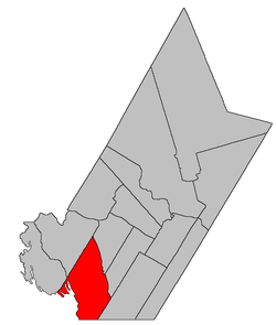 Location within York County, New Brunswick. | |
| Coordinates: 45°41′N 67°24′W / 45.68°N 67.40°W | |
| Country |
|
| Province |
|
| County | York |
| Established | 1894 |
| Area[1] | |
| • Land | 537.62 km2 (207.58 sq mi) |
| Population (2011)[1] | |
| • Total | 27 |
| • Density | 0.1/km2 (0.3/sq mi) |
| • Pop 2006-2011 |
|
| • Dwellings | 14 |
| Time zone | UTC-4 (AST) |
| • Summer (DST) | UTC-3 (ADT) |
McAdam is a Canadian parish in York County, New Brunswick.[2]
History
McAdam Parish set up from Prince William Parish, Dumfries Parish and Manners Sutton Parish in 1894: named for John McAdam (1807-1893), a local lumberman and Member of the Legislative Assembly for the county of Charlotte from 1854-1866.
Delineation
McAdam Parish is defined in the Territorial Division Act[3] as being bounded:
- East by Dumfries and Prince William Parishes; southeast by Manners Sutton Parish; south and southwest by the County line and the International Boundary; northwest by the southwesterly prolongation of a line running southwesterly and parallel to the upper line of Prince William Parish from the southwest angle of lot number six, granted to John Benn below Shogomoc Stream.
Communities
Parish population total does not include incorporated municipalities (in bold):
Bodies of water & Islands
This is a list of rivers, lakes, streams, creeks, marshes and Islands that are at least partially in this parish
- Shogomoc Lake
- Kilburn Lake
- Big Duck Lake
- Rocky Lake
- Fifth Lake
- Sixth Lake
- Thompsons Lake
- Fosters Lake
- Modsley Lake
- Spednic Lake
- Wauklehegan Lake
Demographics
Access Routes
Highways and numbered routes that run through the parish, including external routes that start or finish at the parish limits:[6]
|
|
|
|
See also
References
- 1 2 2011 Statistics Canada Census Profile: McAdam Parish, New Brunswick
- ↑ New Brunswick Provincial Archives - McAdam Parish
- ↑ "Territorial Division Act (R.S.N.B. 1973, c. T-3)". Government of New Brunswick website. Retrieved 23 August 2016.
- ↑ Statistics Canada: 1996, 2001, 2006 census
- ↑ 2006 Statistics Canada Community Profile: McAdam Parish, New Brunswick
- ↑ Atlantic Canada Back Road Atlas ISBN 978-1-55368-618-7
External links
Places adjacent to McAdam Parish, New Brunswick | |
|---|---|
Topics | ||
| History |  | |
| Buildings |
| |
| People | ||
| Subdivisions | |
|---|---|
| Cities | |
| Counties | |
| |
Coordinates: 45°40′48″N 67°24′00″W / 45.68000°N 67.40000°W