Saint-Pardoux-la-Croisille
| Saint-Pardoux-la-Croisille | ||
|---|---|---|
| Commune | ||
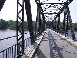 Lantourne viaduct near Marcillac-la-Croisille | ||
| ||
 Saint-Pardoux-la-Croisille Location within Nouvelle-Aquitaine region  Saint-Pardoux-la-Croisille | ||
| Coordinates: 45°14′47″N 1°58′59″E / 45.2464°N 1.9831°ECoordinates: 45°14′47″N 1°58′59″E / 45.2464°N 1.9831°E | ||
| Country | France | |
| Region | Nouvelle-Aquitaine | |
| Department | Corrèze | |
| Arrondissement | Tulle | |
| Canton | Sainte-Fortunade | |
| Intercommunality | Doustre et du Plateau des Étangs | |
| Government | ||
| • Mayor (2008–2014) | Cécile Fauche | |
| Area1 | 16.36 km2 (6.32 sq mi) | |
| Population (2008)2 | 170 | |
| • Density | 10/km2 (27/sq mi) | |
| Time zone | UTC+1 (CET) | |
| • Summer (DST) | UTC+2 (CEST) | |
| INSEE/Postal code | 19231 /19320 | |
| Elevation |
424–564 m (1,391–1,850 ft) (avg. 520 m or 1,710 ft) | |
|
1 French Land Register data, which excludes lakes, ponds, glaciers > 1 km2 (0.386 sq mi or 247 acres) and river estuaries. 2 Population without double counting: residents of multiple communes (e.g., students and military personnel) only counted once. | ||
.svg.png)
Saint-Pardoux-la-Croisille is a commune in the Corrèze department in central France.
Population
| Historical population | ||
|---|---|---|
| Year | Pop. | ±% |
| 1962 | 206 | — |
| 1968 | 240 | +16.5% |
| 1975 | 176 | −26.7% |
| 1982 | 168 | −4.5% |
| 1990 | 173 | +3.0% |
| 1999 | 156 | −9.8% |
| 2008 | 170 | +9.0% |
See also
References
| Wikimedia Commons has media related to Saint-Pardoux-la-Croisille. |
This article is issued from
Wikipedia.
The text is licensed under Creative Commons - Attribution - Sharealike.
Additional terms may apply for the media files.