Meilhards
| Meilhards | ||
|---|---|---|
| Commune | ||
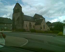 The church in Meilhards | ||
| ||
 Meilhards Location within Nouvelle-Aquitaine region  Meilhards | ||
| Coordinates: 45°33′37″N 1°38′59″E / 45.5603°N 1.6497°ECoordinates: 45°33′37″N 1°38′59″E / 45.5603°N 1.6497°E | ||
| Country | France | |
| Region | Nouvelle-Aquitaine | |
| Department | Corrèze | |
| Arrondissement | Tulle | |
| Canton | Uzerche | |
| Intercommunality | Pays d'Uzerche | |
| Government | ||
| • Mayor (2014–2020) | Jean-Jacques Caffy | |
| Area1 | 44.99 km2 (17.37 sq mi) | |
| Population (2008)2 | 525 | |
| • Density | 12/km2 (30/sq mi) | |
| Time zone | UTC+1 (CET) | |
| • Summer (DST) | UTC+2 (CEST) | |
| INSEE/Postal code | 19131 /19510 | |
| Elevation |
377–580 m (1,237–1,903 ft) (avg. 380 m or 1,250 ft) | |
|
1 French Land Register data, which excludes lakes, ponds, glaciers > 1 km2 (0.386 sq mi or 247 acres) and river estuaries. 2 Population without double counting: residents of multiple communes (e.g., students and military personnel) only counted once. | ||
.svg.png)
Meilhards is a commune in the Corrèze department in central France.
Geography
Location
The municipality is bordered by the department of Haute-Vienne.
Neighbouring communes and villages
Places adjacent to Meilhards | |
|---|---|
Hydrography
Commune watered by the Bradascou, and its tributary the Ganaveix which takes its source in the communal territory.
Population
| Historical population | ||
|---|---|---|
| Year | Pop. | ±% |
| 1962 | 794 | — |
| 1968 | 897 | +13.0% |
| 1975 | 789 | −12.0% |
| 1982 | 700 | −11.3% |
| 1990 | 622 | −11.1% |
| 1999 | 519 | −16.6% |
| 2008 | 525 | +1.2% |
Local Culture and heritage
Places and monuments
- Château de Lachaud
- Tomb of Philippe de Meilhards XVIII, classified by the fine Arts.
- 14th Centuary Church.
- Chapelle Sainte-Radegonde with miraculous fountain.
Cults
For the Catholic cults, Meilhards depended on the diocese of Tulle, and is part of the inter-parochial ensemble of Chambert-Treignac: The deanery of the Middle Vézère.
See also
References
| Wikimedia Commons has media related to Meilhards. |
This article is issued from
Wikipedia.
The text is licensed under Creative Commons - Attribution - Sharealike.
Additional terms may apply for the media files.