Champagnac-la-Noaille
| Champagnac-la-Noaille | ||
|---|---|---|
| Commune | ||
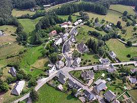 An aerial view of Champagnac-la-Noaille | ||
| ||
 Champagnac-la-Noaille Location within Nouvelle-Aquitaine region  Champagnac-la-Noaille | ||
| Coordinates: 45°18′28″N 2°01′00″E / 45.3077°N 2.0167°ECoordinates: 45°18′28″N 2°01′00″E / 45.3077°N 2.0167°E | ||
| Country | France | |
| Region | Nouvelle-Aquitaine | |
| Department | Corrèze | |
| Arrondissement | Ussel | |
| Canton | Égletons | |
| Intercommunality | Pays de Ventadour, du Doustre et de la Luzège | |
| Government | ||
| • Mayor (2008–2014) | Jean-Marie Nard | |
| Area1 | 25.47 km2 (9.83 sq mi) | |
| Population (2008)2 | 222 | |
| • Density | 8.7/km2 (23/sq mi) | |
| Demonym(s) | Champagnacois | |
| Time zone | UTC+1 (CET) | |
| • Summer (DST) | UTC+2 (CEST) | |
| INSEE/Postal code | 19031 /19320 | |
| Elevation |
492–630 m (1,614–2,067 ft) (avg. 560 m or 1,840 ft) | |
|
1 French Land Register data, which excludes lakes, ponds, glaciers > 1 km2 (0.386 sq mi or 247 acres) and river estuaries. 2 Population without double counting: residents of multiple communes (e.g., students and military personnel) only counted once. | ||
.svg.png)
Champagnac-la-Noaille (Occitan: Champanhac la Noalha) is a commune in the Corrèze department in central France.
Population
| Historical population | ||
|---|---|---|
| Year | Pop. | ±% |
| 1876 | 705 | — |
| 1911 | 813 | +15.3% |
| 1936 | 562 | −30.9% |
| 1954 | 381 | −32.2% |
| 1962 | 351 | −7.9% |
| 1968 | 315 | −10.3% |
| 1975 | 293 | −7.0% |
| 1982 | 258 | −11.9% |
| 1990 | 221 | −14.3% |
| 1999 | 189 | −14.5% |
| 2008 | 222 | +17.5% |
See also
References
External links
| Wikimedia Commons has media related to Champagnac-la-Noaille. |
This article is issued from
Wikipedia.
The text is licensed under Creative Commons - Attribution - Sharealike.
Additional terms may apply for the media files.