Palazinges
| Palazinges | ||
|---|---|---|
| Commune | ||
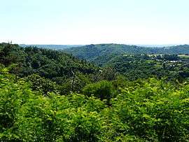 The Coiroux gorge | ||
| ||
 Palazinges Location within Nouvelle-Aquitaine region  Palazinges | ||
| Coordinates: 45°09′36″N 1°41′45″E / 45.16°N 1.6958°ECoordinates: 45°09′36″N 1°41′45″E / 45.16°N 1.6958°E | ||
| Country | France | |
| Region | Nouvelle-Aquitaine | |
| Department | Corrèze | |
| Arrondissement | Brive-la-Gaillarde | |
| Canton | Midi Corrézien | |
| Intercommunality | Canton de Beynat | |
| Government | ||
| • Mayor (2008–2014) | Yves Pouchou | |
| Area1 | 5.25 km2 (2.03 sq mi) | |
| Population (2008)2 | 112 | |
| • Density | 21/km2 (55/sq mi) | |
| Time zone | UTC+1 (CET) | |
| • Summer (DST) | UTC+2 (CEST) | |
| INSEE/Postal code | 19156 /19190 | |
| Elevation |
306–551 m (1,004–1,808 ft) (avg. 560 m or 1,840 ft) | |
|
1 French Land Register data, which excludes lakes, ponds, glaciers > 1 km2 (0.386 sq mi or 247 acres) and river estuaries. 2 Population without double counting: residents of multiple communes (e.g., students and military personnel) only counted once. | ||
.svg.png)
Palazinges is a commune in the Corrèze department in central France.
Population
| Historical population | ||
|---|---|---|
| Year | Pop. | ±% |
| 1962 | 83 | — |
| 1968 | 95 | +14.5% |
| 1975 | 99 | +4.2% |
| 1982 | 100 | +1.0% |
| 1990 | 115 | +15.0% |
| 1999 | 103 | −10.4% |
| 2008 | 112 | +8.7% |
See also
References
| Wikimedia Commons has media related to Palazinges. |
This article is issued from
Wikipedia.
The text is licensed under Creative Commons - Attribution - Sharealike.
Additional terms may apply for the media files.