Saint-Odilon-de-Cranbourne, Quebec
| Saint-Odilon-de-Cranbourne | |
|---|---|
| Parish municipality | |
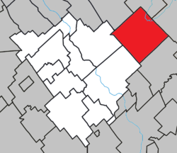 Location within Robert-Cliche RCM. | |
 Saint-Odilon-de-Cranbourne Location in southern Quebec. | |
| Coordinates: 46°22′N 70°41′W / 46.367°N 70.683°WCoordinates: 46°22′N 70°41′W / 46.367°N 70.683°W[1] | |
| Country |
|
| Province |
|
| Region | Chaudière-Appalaches |
| RCM | Robert-Cliche |
| Constituted | July 1, 1855 |
| Government[2] | |
| • Mayor | André Labbé |
| • Federal riding | Beauce |
| • Prov. riding | Beauce-Nord |
| Area[2][3] | |
| • Total | 130.50 km2 (50.39 sq mi) |
| • Land | 129.81 km2 (50.12 sq mi) |
| Population (2011)[3] | |
| • Total | 1,459 |
| • Density | 11.2/km2 (29/sq mi) |
| • Pop 2006-2011 |
|
| • Dwellings | 620 |
| Time zone | UTC−5 (EST) |
| • Summer (DST) | UTC−4 (EDT) |
| Postal code(s) | G0S 3A0 |
| Area code(s) | 418 and 581 |
| Highways |
|
| Website |
saint-odilon |
Saint-Odilon-de-Cranbourne is a parish municipality in Robert-Cliche Regional County Municipality the Chaudière-Appalaches region of Quebec, Canada. Its population is 1,459 as of the Canada 2011 Census. The parish's name honours Reverend Pierre-François-Xavier-Odilon-Marie-Alphonse Paradis, first priest of Saint-Odilon-de-Cranbourne, while "Cranbourne" comes from Cranborne, a village in East Dorset, England.
People linked to Saint-Odilon-de-Cranbourne
- Simon Nolet, a former National Hockey League player
- Prosper-Edmond Lessard, (1873-1931) Alberta politician
References
External links
- Saint-Odilon-de-Cranbourne (in French)
Places adjacent to Saint-Odilon-de-Cranbourne, Quebec | ||||||||||
|---|---|---|---|---|---|---|---|---|---|---|
| ||||||||||
| Cities & Towns | |
|---|---|
| Municipalities | |
| Parishes | |
| Villages | |
| |
This article is issued from
Wikipedia.
The text is licensed under Creative Commons - Attribution - Sharealike.
Additional terms may apply for the media files.