Saint-Norbert-d'Arthabaska, Quebec
| Saint-Norbert-d'Arthabaska | |
|---|---|
| Municipality | |
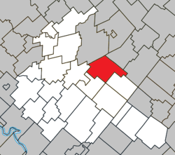 Location within Arthabaska RCM. | |
 Saint-Norbert-d'Arthabaska Location in southern Quebec. | |
| Coordinates: 46°06′N 71°49′W / 46.100°N 71.817°WCoordinates: 46°06′N 71°49′W / 46.100°N 71.817°W[1] | |
| Country |
|
| Province |
|
| Region | Centre-du-Québec |
| RCM | Arthabaska |
| Constituted | October 21, 2009 |
| Government[2] | |
| • Mayor | Ghislain Caouette |
| • Federal riding | Richmond—Arthabaska |
| • Prov. riding | Arthabaska |
| Area[2][3] | |
| • Total | 102.70 km2 (39.65 sq mi) |
| • Land | 103.72 km2 (40.05 sq mi) |
|
There is an apparent contradiction between two authoritative sources | |
| Population (2011)[3] | |
| • Total | 1,185 |
| • Density | 11.4/km2 (30/sq mi) |
| • Pop 2006-2011 |
|
| Time zone | UTC−5 (EST) |
| • Summer (DST) | UTC−4 (EDT) |
| Postal code(s) | G0P 1B0 |
| Area code(s) | 819 |
| Highways |
|
Saint-Norbert-d'Arthabaska is a municipality located in the Centre-du-Québec region of Quebec, Canada.
References
Places adjacent to Saint-Norbert-d'Arthabaska, Quebec | ||||||||||
|---|---|---|---|---|---|---|---|---|---|---|
| ||||||||||
| Cities | |
|---|---|
| Municipalities | |
| Parishes | |
| Townships | |
| |
This article is issued from
Wikipedia.
The text is licensed under Creative Commons - Attribution - Sharealike.
Additional terms may apply for the media files.