Saint-Léger, Alpes-Maritimes
| Saint-Léger | ||
|---|---|---|
| Commune | ||
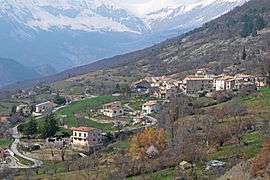 A view of the village of Saint-Léger from the Col Éponyme | ||
| ||
 Saint-Léger Location within Provence-A.-C.d'A. region  Saint-Léger | ||
| Coordinates: 44°00′02″N 6°49′45″E / 44.0006°N 6.8292°ECoordinates: 44°00′02″N 6°49′45″E / 44.0006°N 6.8292°E | ||
| Country | France | |
| Region | Provence-Alpes-Côte d'Azur | |
| Department | Alpes-Maritimes | |
| Arrondissement | Nice | |
| Canton | Vence | |
| Intercommunality | Vallées d'Azur | |
| Government | ||
| • Mayor (2014–2020) | Laurent Don | |
| Area1 | 4.61 km2 (1.78 sq mi) | |
| Population (2012)2 | 69 | |
| • Density | 15/km2 (39/sq mi) | |
| Time zone | UTC+1 (CET) | |
| • Summer (DST) | UTC+2 (CEST) | |
| INSEE/Postal code | 06124 /06260 | |
| Elevation |
590–1,600 m (1,940–5,250 ft) (avg. 1,000 m or 3,300 ft) | |
|
1 French Land Register data, which excludes lakes, ponds, glaciers > 1 km2 (0.386 sq mi or 247 acres) and river estuaries. 2 Population without double counting: residents of multiple communes (e.g., students and military personnel) only counted once. | ||

Saint-Léger (Occitan: Sant Leugier) is a commune in the Alpes-Maritimes department in southeastern France.
Population
| Historical population | ||
|---|---|---|
| Year | Pop. | ±% |
| 1962 | 26 | — |
| 1968 | 44 | +69.2% |
| 1975 | 23 | −47.7% |
| 1982 | 40 | +73.9% |
| 1990 | 54 | +35.0% |
| 1999 | 65 | +20.4% |
| 2008 | 69 | +6.2% |
| 2012 | 69 | +0.0% |
See also
References
| Wikimedia Commons has media related to Saint-Léger, Alpes-Maritimes. |
This article is issued from
Wikipedia.
The text is licensed under Creative Commons - Attribution - Sharealike.
Additional terms may apply for the media files.