La Tour, Alpes-Maritimes
| La Tour | ||
|---|---|---|
| Commune | ||
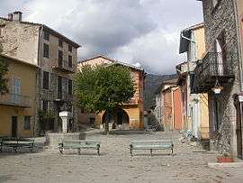 The square in the village of La Tour | ||
| ||
 La Tour Location within Provence-A.-C.d'A. region  La Tour | ||
| Coordinates: 43°56′52″N 7°11′06″E / 43.9478°N 7.185°ECoordinates: 43°56′52″N 7°11′06″E / 43.9478°N 7.185°E | ||
| Country | France | |
| Region | Provence-Alpes-Côte d'Azur | |
| Department | Alpes-Maritimes | |
| Arrondissement | Nice | |
| Canton | Vence | |
| Intercommunality | Métropole Nice Côte d'Azur | |
| Government | ||
| • Mayor (2008–2014) | Pierre-Paul Danna | |
| Area1 | 36.7 km2 (14.2 sq mi) | |
| Population (2008)2 | 439 | |
| • Density | 12/km2 (31/sq mi) | |
| Demonym(s) | Tourriers | |
| Time zone | UTC+1 (CET) | |
| • Summer (DST) | UTC+2 (CEST) | |
| INSEE/Postal code | 06144 /06710 | |
| Elevation |
195–1,900 m (640–6,234 ft) (avg. 640 m or 2,100 ft) | |
|
1 French Land Register data, which excludes lakes, ponds, glaciers > 1 km2 (0.386 sq mi or 247 acres) and river estuaries. 2 Population without double counting: residents of multiple communes (e.g., students and military personnel) only counted once. | ||
_06.svg.png)
La Tour is a commune in the Alpes-Maritimes department in southeastern France.
Population
| Historical population | ||
|---|---|---|
| Year | Pop. | ±% |
| 1962 | 150 | — |
| 1968 | 170 | +13.3% |
| 1975 | 176 | +3.5% |
| 1982 | 148 | −15.9% |
| 1990 | 286 | +93.2% |
| 1999 | 300 | +4.9% |
| 2008 | 439 | +46.3% |
See also
References
| Wikimedia Commons has media related to La Tour, Alpes-Maritimes. |
This article is issued from
Wikipedia.
The text is licensed under Creative Commons - Attribution - Sharealike.
Additional terms may apply for the media files.