Rural Municipality of Reynolds
The Rural Municipality of Reynolds is located in southeastern Manitoba, Canada. By area, it is the largest rural municipality in Manitoba, at 3,573.3 km² (1,379.66 sq mi). Most of Manitoba's Sandilands Provincial Forest and Agassiz Provincial Forest are located here, as is part of Whiteshell Provincial Forest (most of which lies within Whiteshell Provincial Park, outside the RM).

Log Cabin near Medika
Communities
- Culver
- East Braintree
- Hadashville
- Hazel
- Hocter
- Indigo
- Larkhall
References
- the Rural Municipality of Reynolds website
- Manitoba Historical Society - Rural Municipality of Reynolds
- Map of Reynolds R.M. at Statcan
Division No. 1, Manitoba (Eastern Manitoba) | ||
|---|---|---|
| Towns | 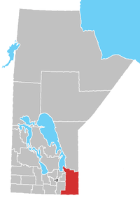 | |
| Local government districts | ||
| Rural municipalities | ||
| First Nations | ||
| Indian reserves |
| |
| Unorganized areas | ||
| Unincorporated communities | ||
Coordinates: 49°46′04″N 95°53′03″W / 49.76778°N 95.88417°W
This article is issued from
Wikipedia.
The text is licensed under Creative Commons - Attribution - Sharealike.
Additional terms may apply for the media files.