Rural Municipality of Hanover
| Rural Municipality of Hanover | |
|---|---|
 The Location of the RM of Hanover in southern Manitoba | |
| Coordinates: 49°26′36″N 96°50′57″W / 49.44333°N 96.84917°WCoordinates: 49°26′36″N 96°50′57″W / 49.44333°N 96.84917°W | |
| Country | Canada |
| Province | Manitoba |
| Region | Eastman |
| Government | |
| • Reeve | Stan Toews |
| Area | |
| • Total | 741.52 km2 (286.30 sq mi) |
| Elevation | 268 m (879 ft) |
| Population (2016 Census[1]) | |
| • Total | 15,733 |
| • Density | 21.2/km2 (55/sq mi) |
| Time zone | UTC-6 (CST) |
| • Summer (DST) | UTC-5 (CDT) |
| Website | http://www.hanovermb.ca/ |
Hanover is a rural municipality in southeastern Manitoba, Canada, southeast of Winnipeg. It is located in Division No. 2. The city of Steinbach and town of Niverville are adjacent to Hanover and operate as separate urban municipalities.
History
The area of Hanover was part of the traditional lands of the Anishinabe, Ojibway speaking natives of the area. In the summer of 1871 the federal government signed treaties with these people putting them on reserves like the Roseau River Anishinabe First Nation to the south and the Brokenhead Ojibway Nation to the north.[2]
From these lands the Manitoba government set aside the East Reserve of which was slightly smaller than what is now the RM of Hanover. The East Reserve was set aside for the new German speaking Mennonites immigrants from Russia coming to the province.[3] In 1880 the province created the RM of Hespeler in honour of William Hespeler, who had brought many of the Mennonite immigrants to the area. The RM of Hanover was created on May 25, 1881 during the same time when most of the province was reorganizing itself into new rural municipalities.[3] In 1881 the East Reserve was divided into 2 municipalities, Hespeler in the north and Hanover in the south. In 1890 the two municipalities merged in order to form the single municipality of Hanover.[3]
The primary settlers were as mentioned German speaking Mennonites from Russia, French, and Anglo Saxons.[3]
Demographics
Hanover has seen steady population growth in recent years and is currently the most populated rural municipality in Manitoba, slightly ahead of Springfield. It has a population of 15,733 as of the Canada 2016 census, which is a 12.2% increase from 2011. The population density of 21.2 persons per square kilometer is up from 16.0 in 2006.[4][5]
Local Urban Districts

Communities
- Barkfield
- Bristol
- Friedensfeld
- Kleefeld
- Hochstadt
- New Bothwell
- Pansy
- Randolph
- Sarto
- Tourond
External links
References
- ↑ "Population data for Hanover". Statistics Canada. Retrieved February 20, 2017.
- ↑ "History and Heritage of Roseau River First Nation". Retrieved 2010-07-01.
- 1 2 3 4 "RM of Hanover History". RM of Hanover History. Archived from the original on May 30, 2010. Retrieved 2010-07-11.
- ↑ http://www12.statcan.gc.ca/census-recensement/2016/dp-pd/prof/details/page.cfm?Lang=E&Geo1=CSD&Code1=4602041&Geo2=PR&Code2=01&Data=Count&SearchText=Hanover&SearchType=Begins&SearchPR=01&TABID=1&B1=All
- ↑ http://www12.statcan.ca/english/census06/data/popdwell/Table.cfm?T=302&SR=101&S=1&O=A&RPP=25&PR=46&CMA=0 Canada 2006 Census
Places adjacent to Rural Municipality of Hanover | ||||||||||
|---|---|---|---|---|---|---|---|---|---|---|
| ||||||||||
| Cities | 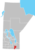 | ||
|---|---|---|---|
| Towns | |||
| Villages | |||
| Rural municipalities |
| ||
| First Nations | |||
| Indian reserves | |||
| Unincorporated communities | |||