La Rochelle, Manitoba
| La Rochelle | |
|---|---|
 La Rochelle Location of La Rochelle in Manitoba | |
| Coordinates: 49°21′20″N 96°58′48″W / 49.35556°N 96.98000°WCoordinates: 49°21′20″N 96°58′48″W / 49.35556°N 96.98000°W | |
| Country |
|
| Province |
|
| Region | Eastman |
| Census Division | No. 2 |
| Government | |
| • Governing Body | Rural Municipality of De Salaberry Council |
| • MP | Ted Falk |
| • MLA | Cliff Graydon |
| Time zone | UTC−6 (CST) |
| • Summer (DST) | UTC−5 (CDT) |
| Area code(s) | 204, 431 |
| NTS Map | 062H07 |
| GNBC Code | GAOFK |
La Rochelle is a locality within the Rural Municipality of De Salaberry in south-eastern Manitoba, Canada. It is located approximately 60 kilometers (37 miles) south of Winnipeg.[1] Established by Métis families in 1859, La Rochelle is the oldest community of the Rural Municipality of De Salaberry.[2]
La Rochelle was the site of a small prisoner-of-war camp the held German soldiers captured during World War II.[3]
References
- ↑ "Geographical Names of Canada - Querying Distances". nrcan.gc.ca. 2011-10-24. Retrieved 2013-02-16.
- ↑ "The Rural Municipality of De Salaberry - Our Municipality - RM Communities - La Rochelle". www.rmdesalaberry.mb.ca. 2011. Retrieved 2013-02-17.
- ↑ "German POW Camp Near St Pierre". SteinbachOnline.com. 2010-07-10.
| Cities | 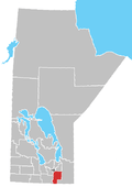 | ||
|---|---|---|---|
| Towns | |||
| Villages | |||
| Rural municipalities |
| ||
| First Nations | |||
| Indian reserves | |||
| Unincorporated communities | |||
This article is issued from
Wikipedia.
The text is licensed under Creative Commons - Attribution - Sharealike.
Additional terms may apply for the media files.